 AZ Ultra Adventure
On this page
- SD100 in 60 seconds
- It's not a June race anymore
- Entry, qualifier and the stuff people miss
- The course, in four acts
- Every aid station (2026 official chart)
- Pacers
- Crew guide: driving the Sunrise Highway
- Where poles help
- What the race page doesn't say
- The finish line is decided here: Sweetwater, mile 41.4
- Gear and packing list for SD100
- The van idea: a base camp on Sunrise Highway
- San Diego 100 FAQ
The San Diego 100 doesn't feel like a 100-miler in the first 12 miles, and the course is set up that way on purpose.
You start at a quiet lake at 4,600 feet in the Cuyamaca mountains east of San Diego, loop around a granite dome, and run through oak and pine on cool morning trail. By noon you're on burned-out ridges in full sun, carrying 70 ounces because the race makes you, and by mile 41 a lot of the field has decided they're done. The second half is the Laguna Mountains and the Pacific Crest Trail at night, with the desert floor dropping off thousands of feet to your right.
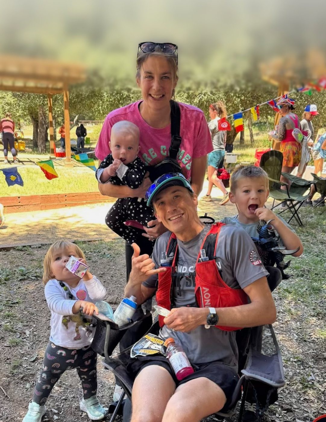
I finished it on May 1-2, 2026, in 28:37:12, with my wife Claire and our three kids crewing me from a cooler of cold chocolate milk. This is the guide I wish I'd had: every aid station, every crew stop, the cutoffs, the climbs, and where the race actually gets decided. Everything factual comes from the race's official 2026 Participant Guide and site. Where 2027 details aren't published yet, I say so.
SD100 in 60 seconds
| Next race | Friday, April 30, 2027, 6:00 AM (the 25th running) |
| Start / finish | Lake Cuyamaca, south lot, 15027 Hwy 79, Julian, CA (9 miles south of Julian) |
| Distance | 100.6 miles (one big lollipop-shaped loop) |
| Climbing | About 15,000 ft up and 15,000 down per the official guide. UltraSignup lists about 15,600 |
| Elevation | Roughly 3,000 to 6,500 ft. Cuyamaca Peak at mile 19.7 is the top |
| Time limit | 32 hours (2:00 PM Saturday). Sub-24 buckle and finisher buckle |
| Entry | First come, first served on UltraSignup. Opens Jan 1, 2027 at 12:01 AM Pacific. No lottery |
| Qualifier | A 50-miler under 13 hours, or a 100K/100-mile finish within its limit, between Jan 1, 2025 and Apr 1, 2027 |
| Volunteer requirement | 6 hours of trail work or race volunteering, or a donation instead (the site says $105, UltraSignup says $100; check at signup) |
| Pacers | One at a time, starting at Sweetwater (mile 41.4) |
| Crew | Six crew points plus start/finish, with a parking pass required |
| Surface | About 80% singletrack, 17% fire road, 3% pavement, roughly 20 miles on the PCT |
| Finish rate | 2026: 126 of 188 starters (67%). 2025: 135 of 228 (59%) |
| Official site | sandiego100.com, UltraSignup 2027 |
It's not a June race anymore
If you have SD100 filed in your head as "early June, hot," update it. The race ran in June for most of its history (2025 was June 6), then moved to the first weekend of May in 2026 and is set for April 30, 2027. UltraRunning magazine covered the change under the headline "25 years and a new race date."
What that means for you:
- Training block. Your peak weeks land in March and early April. For Arizona runners that's perfect: it's the best long-run weather we get all year.
- Heat is still real. The official guide still says to expect lows in the 40s and highs in the mid-80s, with strong wind. 2026 was mid-70s and sunny on the exposed ridges, and with almost no shade that still cooks you. Don't read "spring" as "cool."
- Nights are cold. The Laguna crest sits around 5,500-6,000 ft. Runners have reported shivering by mile 59 after a hot afternoon. You need a real layer in your Penny Pines or Meadows bag.
Entry, qualifier and the stuff people miss
SD100 has no lottery. Registration opens January 1 at 12:01 AM Pacific on UltraSignup and runs until the field fills (the race site says 300 runners or April 1; UltraSignup's listing says 200 runners or April 15, so trust whichever the race confirms when you register). If it fills, there's an ordered waitlist.
Three rules catch people every year:
- Your qualifier must fit the window (Jan 1, 2025 to Apr 1, 2027): a 50-miler under 13 hours, or any 100K or 100-mile finish inside its official limit.
- The volunteer requirement is enforced. Six hours of trail work or race volunteering, or a donation to the trail fund. The guide says plainly they enforce it.
- The race briefing is a video with a password in it. There's no in-person briefing. You watch the mandatory video, and it gives you the word you need to pick up your bib. Don't be the person watching it on a phone in the parking lot at 4:45 AM.
Divisions: you choose Crewed or Solo. Solo means no crew, no pacers and no spectators except at the start/finish, and you wear a wristband. You can switch only before April 15.
Early start: runners over 60 can request a 5:00 AM start, but aid stations open on the normal schedule, so you're self-supported until roughly Cuyamaca Peak.
Western States: the race site says the 2026 SD100 qualifies for the 2027 Western States lottery. That's the finish that put my one ticket in this year's hat. Whether the April 2027 edition is on the Western States list for the 2028 lottery wasn't posted when I checked; look at wser.org's qualifying races page before you count on it.
The course, in four acts
Look at the official course page, the GPX file, the maps PDF and the 2026 turn-by-turn. The race doesn't publish an embeddable map, so here's the official page:
Act 1: Cuyamaca, miles 0-29. The first 12.7 miles to Trout Pond are the nicest running of the day: Cold Spring and Cold Stream, then up and over Stonewall Peak and a rocky, technical descent. Then comes the real first test, Middle Peak and the Conejos trail up Cuyamaca Peak. The guide describes it as rocky, technical and unrelenting, and it ends on a steep paved summit road at the high point of the course (about 6,500 ft, mile 19.7). From the top it's a long drop through burned-over forest (the "veggie tunnel") past the Airplane Monument to Green Valley at 29.4.
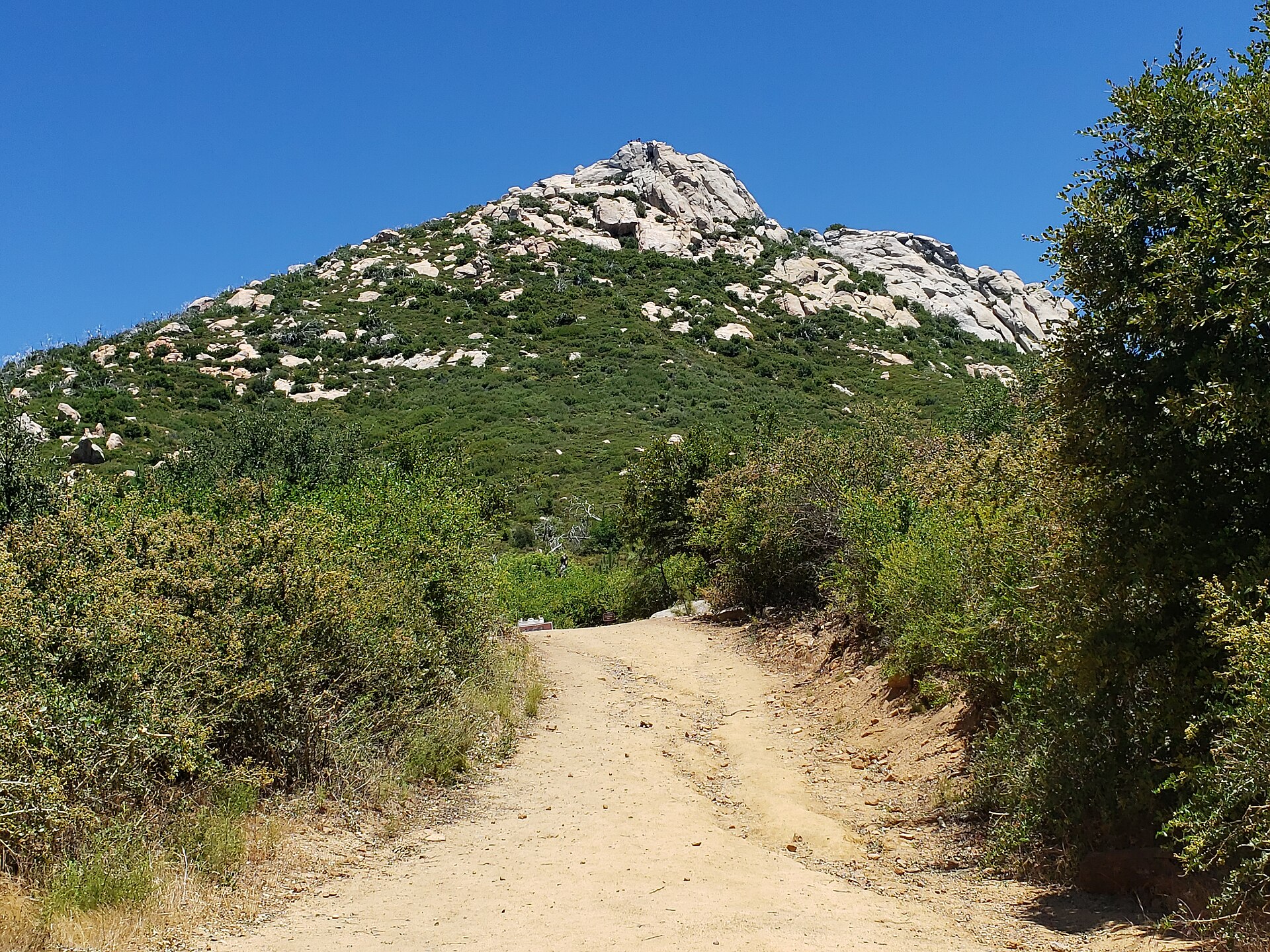
Act 2: The furnace, miles 29-52. Green Valley to Sweetwater is the section the official guide calls "THE HARDEST SECTION" in capital letters. You climb Pine Ridge (1.5 miles of false summits), then Saddleback, then the exposed Blue Ribbon climb, at midday, with no shade worth mentioning. You're required to leave Green Valley carrying 70 oz of fluid, and the same rule applies leaving Sweetwater. After Sweetwater come the Harvey Moore switchbacks, the water-only stop at Pine Creek Road, two miles of pavement downhill, and Hammer's Hideaway at 51.8.
Act 3: Noble Canyon to the crest, miles 52-71. From Hammer's you go up Noble Canyon, a long, rocky climb from the hot canyon bottom up to Penny Pines at 59.2. In the afternoon the lower part is technical, rolling desert. Per the guide, 80-90% of the race's climbing is done by Penny Pines 1. Then it's Laguna Meadows and a short, steep, technical climb with a lot of false summits up to Red Tail Roost at 70.6.
Act 4: The PCT at night, miles 71-100. Right after Red Tail there's a hard left onto the Pacific Crest Trail that the guide says many runners miss. Then it's miles of rocky PCT along the edge of the Laguna Mountains, looking down into the Anza-Borrego desert, with toe-catching rocks in the dark and wind. Pioneer Mail to Sunrise (84.6-91.6) is the section the guide calls the "most dangerous" of the race: weak cell coverage, crazy winds, and heat even early in the morning, with evacuations there in past years. From Sunrise it's rolling highway-side trail and meadows back to the lake.
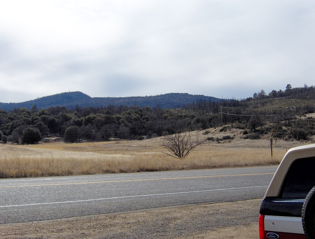
The race recommends a 10-part video tour of the course by Brian Gonzalez (Cliffs and Meadows). If you only watch one part, make it the section that ends the most races, Green Valley to Sweetwater:
Every aid station (2026 official chart)
These are the 2026 numbers from the official Participant Guide, with clock times for the 6:00 AM Friday start. The 2027 racebook may change them, so check the current guide during race week. Cutoffs are strictly enforced: leave after one and you're DQ'd and banned from the San Diego Ultra Slam races. You also can't go backward. Once you leave a station, you continue to the next one.
| # | Aid station | Mile | To next | Cutoff | Drop bag | Crew | Pacer | Notes |
|---|---|---|---|---|---|---|---|---|
| 0 | Start, Lake Cuyamaca | 0.0 | 12.7 | 6:00 AM Fri | – | Yes | – | No passing for the first half mile. Poles stay stowed for mile 1 |
| 1 | Trout Pond | 12.7 | 7.0 | 10:00 AM | No | No | – | After the Stonewall Peak loop. Cross Hwy 79 carefully |
| 2 | Cuyamaca Peak | 19.7 | 9.7 | 12:45 PM | Yes | No | – | Top of the course after the Conejos grind. Long descent next |
| 3 | Green Valley | 29.4 | 6.2 | 3:30 PM | No | Yes | – | Must leave with 70 oz. Hardest section starts here |
| 3a | Blue Ribbon (water only) | 35.6 | 5.9 | – | No | No | – | Unmanned. You can't drop here |
| 4 | Sweetwater | 41.4 | 8.1 | 7:00 PM | Yes | Yes | Pacers start | Most DNFs happen here. Must leave with 70 oz |
| 4a | Pine Creek Road (water only) | 49.5 | 2.3 | – | No | No | – | Unmanned. 2 miles of paved downhill follow |
| 5 | Hammer's Hideaway | 51.8 | 7.4 | 10:15 PM | Yes | No | – | Fill up for Noble Canyon |
| 6 | Penny Pines 1 | 59.2 | 5.1 | 1:00 AM Sat | Yes | No (since 2024) | – | Top of Noble. 80-90% of the climbing done |
| 7 | Meadows | 64.3 | 6.3 | 2:45 AM | No | Yes | Swap | Navigation can be tricky |
| 8 | Red Tail Roost | 70.6 | 5.0 | 4:45 AM | Yes | Yes | Swap | Steep technical climb before it. Hard left onto the PCT after |
| 9 | Per's Cabin | 75.6 | 5.1 | 6:15 AM | No | No | – | PCT, wind, desert views |
| 10 | Penny Pines 2 | 80.7 | 3.9 | 7:45 AM | Yes | No | – | Across the road from Penny Pines 1 |
| 11 | Pioneer Mail | 84.6 | 7.1 | 9:00 AM | Yes | Yes | Swap | Captains lean toward NOT letting you continue if you look bad |
| 12 | Sunrise | 91.6 | 9.0 | 11:15 AM | Yes | Yes | Swap | Strong cell signal. Leave with ice |
| 13 | Finish, Lake Cuyamaca | 100.6 | – | 2:00 PM Sat | Returned | Yes | – | Family can run in from the picnic tables, about 0.5 mi out |
Drop bags must fit 16 × 12 × 6 inches and go to Cuyamaca Peak, Sweetwater, Hammer's, Penny Pines 1 and 2, Red Tail, Pioneer Mail and Sunrise. Label them with the station names exactly as the race writes them. A 2026 finisher wrote that he mislabeled his because he'd copied station names from an AI summary. Use the official chart.
The two water-only stops (Blue Ribbon and Pine Creek Road, which the guide's text also calls "Big Oak") are unmanned. You can't drop there, and nobody is going to help you.
Pacers
- One pacer at a time, starting at Sweetwater (41.4). Pacers can swap at Meadows, Red Tail, Pioneer Mail and Sunrise.
- Pacers check in and out with their runner. There are no pacer bibs.
- No muling (your pacer can't carry your stuff) and no physical help.
- Any number of family and friends can run the last half mile in from the picnic tables, Solo runners included. If you're planning one memory from the weekend for your family, plan this one.
If you only get one pacer, the night PCT miles from Red Tail (70.6) or Pioneer Mail (84.6) are where a fresh voice helps most. One 2024 finisher's crew found a replacement pacer at Meadows after the plan fell apart. People are generous at this race, but don't count on it.
Crew guide: driving the Sunrise Highway
SD100 is a good crew race. The crew points all sit on two highways (Hwy 79 and the Sunrise Highway, S-1), and the drives between them are short and paved. The rules are strict, though, so read this part twice.
Parking pass: every crewed runner gets one SD100 parking pass, handed out at the crew briefing at about 6:10 AM Friday at the start. Crewing without the pass means your runner is immediately disqualified. Crew only at the official points. Meeting your runner anywhere else risks a penalty or DQ. Penny Pines lost crew access in 2024 because of how crews behaved there, and the guide says Green Valley is "under a microscope." Don't be the reason it goes too.
Park fees: the state park stops (Green Valley, Sweetwater, Sunrise) take one state park day pass, bought from the machine at Paso Picacho or Green Valley, or $10 cash at Sweetwater. The Cleveland National Forest stops (Meadows, Red Tail, Pioneer Mail) need a $5 Adventure Pass. Buy it ahead at the Pine Valley market, the Mount Laguna General Store or the visitor center. No dogs at aid stations or on the course.
| Leg | How to get there | Drive | Parking and signal |
|---|---|---|---|
| Lake → Green Valley (29.4) | Hwy 79 south 7.6 mi to Green Valley Campground, pay, turn right to the Arroyo Seco picnic area | ~15 min | Very tight. You may walk 0.5-1 mi. Weak cell. Crews may walk in only when their runner is within 2 mi |
| Green Valley → Sweetwater (41.4) | Hwy 79 north 1 mi, on the right (search "Harvey Moore Trailhead") | ~3 min | Lot only; roadside cars get ticketed. Weak cell. Your runner takes a 12-mile route, so don't rush over |
| Sweetwater → Meadows (64.3) | 79 south 5 mi to Old Hwy 80, east 6.5 mi through Pine Valley (gas, food), then the Sunrise Highway (S-1) north about 5.3 mi ("Laguna Meadows information kiosk") | ~25 min | Both shoulders of S-1. The aid station area is tight |
| Meadows → Red Tail Roost (70.6) | S-1 north 3.5 mi to mile marker 22.5 | ~8 min | Roadside or lot. Mount Laguna store and food nearby |
| Red Tail → Pioneer Mail (84.6) | S-1 north 6.7 mi, on the right | ~10 min | Roadside facing traffic, or the lot |
| Pioneer Mail → Sunrise (91.6) | S-1 north 5 mi to mile marker 34.5 | ~8 min | Diagonal roadside or lot. Strong cell |
| Sunrise → Finish | S-1 north 3 mi to Hwy 79, left 3 mi, then left into the north lot just past the Lake Cuyamaca Restaurant | ~8 min | Not in front of the restaurant. Strong cell |
Crew tips:
- Gas up before Friday. The only fuel is in Pine Valley, Descanso and Julian.
- The Sunrise Highway at night is dangerous: fast motorcycles by day, deer at night, drivers who don't expect people on the shoulder. Headlamps and reflective vests for anyone walking along it.
- Track from where there's signal. The guide's own advice: wait at the lake or at Sunrise, where the signal is good, and drive out once your runner shows up on the tracker (GeoTracks GPS plus Ultralive splits).
- The long gap. After Sweetwater (41.4) your runner is gone until Meadows (64.3), 23 miles and usually 7-9 hours of Noble Canyon. That's the window to eat a real dinner in Pine Valley, nap, and refill the cooler.
- If your runner drops, you'll probably be asked to give another dropped runner a ride too. The sweep shuttle only comes after a station closes.
For an Arizona crew, SD100 is about five and a half hours from Phoenix on I-8, and the crew points are close enough together that one vehicle can do all of them. That makes it a great race for a rolling base camp: a place for the kids to sleep through the Noble Canyon gap, ice that's still ice at Pioneer Mail on Saturday morning, and a bed for the runner at the lake afterward.
Where poles help
Poles are allowed, but not during the first mile, which is narrow and crowded. After that, they help on these climbs:
- Conejos to Cuyamaca Peak (miles 13-19.7). Rocky, steep, sustained, then a steep paved road. Carry them from the start.
- Pine Ridge, Saddleback and Blue Ribbon (29-41). Short, steep and hot. Poles keep your heart rate down in the heat.
- Harvey Moore switchbacks (after 41.4).
- Noble Canyon (51.8-59.2). The longest climb of the race. If you've been running without poles, pick them up from your Hammer's Hideaway drop bag (51.8).
- The climb to Red Tail Roost (~68-70.6). Steep, technical, false summits, in the middle of the night.
When to grab them, when to drop them: most people who use poles carry them all day. If you'd rather not, pack a pair in your Sweetwater bag (crew is there too) for everything from 41 to 70, and hand them to your crew at Pioneer Mail or Sunrise. From Sunrise to the finish is rolling, runnable terrain where poles mostly get in the way.
What the race page doesn't say
Reddit was thin on current-course SD100 threads when I looked, so most of this comes from the race director's own FAQ, finishers' blogs and my own race.
- "Harder than it looks on paper." That's from the official guide, and it's right. The vert numbers look moderate for a mountain 100, but the rock is relentless. Feet and ankles tire before legs do.
- Eat early. The race's advice is to eat before the heat, because once it's hot, eating gets hard. A 2026 finisher who placed second overall wrote that drink mix mixed too strong in the sun made him throw up in Noble Canyon. Go weaker than you think, and alternate with plain water.
- Ice in the hat for Green Valley to Sweetwater and for Noble. Soak your hat and shirt at the Saddleback creek crossing.
- Blow the air out of your bladder before you reseat it in your pack. Small thing, real sloshing, real misery over 12 miles.
- Penny Pines 1 is the hinge. The guide's FAQ says it plainly: if you get out of PP1 even feeling bad, the rolling section afterward lets you recover.
- The PCT turn after Red Tail. It's a hard left, and runners miss it every year. Know it's coming.
- Course markings have been vandalized before. Load the GPX on your watch and know the turn-by-turn.
- Pioneer Mail captains are conservative. If you come in wobbly, they may hold you. Arrive looking like someone who's going to finish: eat, drink, layer up, and be ready to talk clearly.
What I'd tell you from my own race: I finished in 28:37, 50th overall, with my family crewing. What got me through wasn't fitness. It was having something I could always get down: cold whole chocolate milk out of a cooler, every crew stop, and I've written a whole post on why. The night section stretched and compressed time in ways I tried to describe here. And having my own family at the crew stops did more for me than any gel.
More reports worth reading: Nick's 2026 SD100 report, a 2024 finisher's Substack, and Makai Clemons' course-record story on Patagonia. Race photos are by Howie Stern: browse the galleries instead of hunting for them on social media.
The finish line is decided here: Sweetwater, mile 41.4
The official guide says it directly: most runners drop at Sweetwater. Usually not because of the cutoff (7:00 PM gives you 13 hours for 41 miles). They drop because Green Valley to Sweetwater cooked them, their stomach shut down, and the thought of Harvey Moore and Noble Canyon in the afternoon feels impossible.
So the plan is simple: arrive at Sweetwater with something left, and leave Sweetwater no matter how you feel.
- Before Green Valley: keep Cuyamaca Peak easy. You'll pass people on the descent, and that's fine; the climb isn't where you make up time.
- Green Valley to Sweetwater: this is a hot hiking section, not a racing section. 70 oz plus ice, eat every 30-40 minutes even if it's small, soak at the creek.
- At Sweetwater: your crew and maybe your pacer are here. Chair rule: five minutes, maximum. Cold drink, real food, sunscreen, fresh socks if your feet are wet, and out. If you feel awful, walk out eating. Most people feel better within an hour once the sun drops.
- The second danger zone is Noble Canyon in the late afternoon (52-59). Long, hot and lonely. Hammer's is your fill-up: take everything.
- Get to Penny Pines 1 (59.2) and the hard part is mostly behind you. 80-90% of the climbing is done. From there it's cold, dark and rocky, but mostly runnable, and the crew points come close together (Meadows, Red Tail, Pioneer Mail, Sunrise).
- Get out of Sunrise (91.6) and you're finishing. Nine miles, mostly runnable, strong cell service, and a 2:00 PM cutoff that's hours away for most runners. Don't sit down at Sunrise. Take ice for the last stretch and go.
Night and cold: you'll hit the PCT in the dark around 5,500-6,000 ft with wind off the desert. Put a real jacket, gloves and a beanie in your Penny Pines 1 or Meadows bag. Runners who were overheating at 4 PM have been shivering by 10 PM.
Feet: the rock never stops. Get your shoes and socks dialed before race day, and change socks at Sweetwater or Red Tail if anything rubs.
What crews should say: "You're not hurt, you're tired. Eat this and walk out with it." Then point at the trail.
Gear and packing list for SD100
Honest picks for this course specifically. These are Amazon affiliate links; if you buy through them, AZ Ultra Adventure earns a small commission at no extra cost to you.
- A vest that carries 70 oz comfortably. The race requires 70 oz out of Green Valley and Sweetwater. A running vest with two soft flasks plus a bladder sleeve lets you carry it without a bottle in your hand.
- Extra soft flasks. A pair of 500 ml soft flasks for the hot sections, so one can be plain water and one can be your drink mix.
- Trekking poles. Lightweight folding carbon poles that stash on your vest for Sunrise to the finish.
- Bright headlamp plus a backup. The PCT at night is rocky and windy. A rechargeable trail headlamp and a small backup light in a drop bag.
- Ice and cooling. A cooling neck gaiter or ice bandana for Green Valley to Sweetwater and Noble.
- Electrolytes. Electrolyte capsules so you can control salt without making your drink too strong (see the Noble Canyon vomiting story above).
- Anti-chafe. A stick of anti-chafe balm. Thirty hours of heat, then cold, then heat.
- Gaiters. Short trail gaiters keep the decomposed granite out of your shoes.
- Warm layer for the Laguna crest. A packable wind jacket plus light running gloves.
- For the crew. A big cooler that holds ice for two days and folding camp chairs (for the crew, not the runner).
The van idea: a base camp on Sunrise Highway
SD100 runs on a short stretch of road, which is a crew's dream: one vehicle can leapfrog every crew point in under 30 minutes of driving. What breaks crews here is the gap between Sweetwater and Meadows and the cold night up on the Laguna crest. A crew van is a base camp you can move: shade at Green Valley, a fridge full of cold drinks and real food, a bed for a crew member to nap through the Noble Canyon window, warm clothes on board at 3 AM, and somewhere to lie down with compression boots on after the finish instead of driving five hours home on no sleep.
That's the idea behind AZ Ultra Vans: race-crew vans for Arizona runners heading to races like this one. We're testing demand with a reservation-interest list, so nothing is guaranteed yet. If you'd use one for SD100, the card above is the way to tell us.
San Diego 100 FAQ
When is the 2027 San Diego 100? Friday, April 30, 2027, 6:00 AM start at Lake Cuyamaca, with a 32-hour limit (2:00 PM Saturday, May 1). The race moved from early June to spring starting in 2026.
How do I get into SD100? Is there a lottery? No lottery. Registration opens January 1, 2027 at 12:01 AM Pacific on UltraSignup, first come, first served until the field fills, then a waitlist. You need a qualifier and the volunteer hours (or a donation instead).
What's the qualifier? A 50-mile finish under 13 hours, or a 100K or 100-mile finish inside its official cutoff, between January 1, 2025 and April 1, 2027.
Is the San Diego 100 a Western States qualifier? The 2026 race qualifies for the 2027 Western States lottery per the race site. For the 2027 race (and the 2028 lottery), check wser.org, because that list is set separately each year.
Where can crew meet runners? Green Valley (29.4), Sweetwater (41.4), Meadows (64.3), Red Tail Roost (70.6), Pioneer Mail (84.6) and Sunrise (91.6), plus start/finish. You need the race's parking pass, plus a state park pass and a $5 Adventure Pass for the national forest stops.
Where can pacers start? Sweetwater, mile 41.4. One at a time, with swaps allowed at Meadows, Red Tail, Pioneer Mail and Sunrise. No muling.
How hard is SD100 compared to other 100s? About 15,000 ft of climbing, a lot of rocky singletrack, and long exposed hot sections. Finish rates were 59% (2025) and 67% (2026). It's harder than a looped desert 100 like Javelina and less brutal than the steepest mountain 100s. The official guide says it's "harder than it looks on paper," and I'd agree.
Can I use poles? Yes, except during the first mile. They're most useful on Cuyamaca Peak, Noble Canyon and the climb to Red Tail Roost.
Who wrote this
Johnathon Lawson is a Gilbert, Arizona ultrarunner, middle school track and cross-country coach, and father of three. He finished the San Diego 100 on May 1-2, 2026 in 28:37:12, crewed by his wife and kids. He's also finished Mogollon Monster 100 (2025) and Zion 100 (2025). Follow his training on Strava, see his race history on UltraSignup, and find AZ Ultra Adventure on YouTube and Instagram.
Sources: San Diego 100 official site and the 2026 Participant Guide (aid chart, cutoffs, crew directions, rules); UltraSignup 2027 registration and results for 2026 and 2025; finisher reports linked above. 2027 cutoffs and crew rules may change. Check the race's current runner guide during race week.
Some links are Amazon affiliate links. As an Amazon Associate we earn from qualifying purchases, at no extra cost to you.