 AZ Ultra Adventure
On this page
- Stagecoach Line 100 at a glance
- The course map
- The course, start to finish
- Every aid station: mile, crew, drop bags, pacers, cutoffs
- Crew guide: the ranch roads
- Pacers
- Where poles help (not much)
- The finish line is decided here
- Insider knowledge
- Gear and packing list
- The van idea for the Stagecoach
- Stagecoach Line 100 FAQ
- Who wrote this
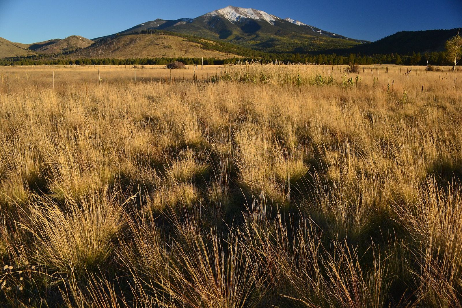
Before the railroad reached the South Rim, getting from Flagstaff to the Grand Canyon meant a long, dusty ride on a stagecoach line across the high ranch country north of the San Francisco Peaks. The Flagstaff to Grand Canyon Stagecoach Line 100 follows that idea on foot: one hundred miles of the Arizona Trail from the Fort Valley trailhead just outside Flagstaff to the edge of Tusayan, a few miles from the canyon rim. You pass the old Moqui Stage Station site along the way.
It's run by the Arizona Trail Association, with race director Ian Torrence, and raises money for the trail itself. It's been running since 2013 and has an old-school feel: a thorough participant manual, ham radio operators at the aid stations, ranch gates you have to close, and a finish in a small parking lot by a bike path in Tusayan. On paper it looks gentle, with about 7,000 feet of gain over 101 miles and one big climb. Runners consistently say it's harder than it looks: it's high (mostly above 7,000 feet), exposed, rocky in places, cold at night, and the crew roads are rougher than the course.
This guide is built from the official 2026 participant manual, the race's course info and results pages, and UltraSignup results data. The 2027 date hadn't been announced when we checked. The race is usually on the third or fourth weekend of September, so watch the official race page.
Stagecoach Line 100 at a glance
| When | Third or fourth weekend of September. 2026 was September 19-20. 2027 not yet announced |
| Start | Fort Valley Trailhead, off US-180 about 4.6 miles north of downtown Flagstaff (about 7,400 ft). Not Buffalo Park |
| Finish | Tusayan Greenway Path parking lot at the north roundabout, Tusayan (about 6,600 ft) |
| Direction | Always south to north, Flagstaff to Tusayan |
| Distance | About 101 miles by the manual (GPX measurements run 99-100+) |
| Elevation | About 7,000 ft of gain. High point about 8,800 ft at Aspen Corner (mile 6) |
| Time limit | 32 hours (course closes 1:00 PM Sunday). Copper buckle for finishing under 31 hours |
| Start time | 5:00 AM. Bikes leave first, runners right after |
| Aid | 12 aid stations plus a crew-only point (Babbitt Lake Yacht Club) |
| Pacers | From Chapel Mountain (mile 44). Swaps only at Boundary, Russell Tank, Hull Cabin and Watson Tank |
| Mandatory | Cold-weather drop bag at Boundary (mile 58): tights or pants, a warm jacket and a knit hat |
| Qualifier | Not on the current Western States qualifier list. Not a UTMB Index race |
| Fee | About $290 for the 100-mile solo in 2026 (from a third-party listing; check UltraSignup). Shuttle extra |
| Other events | 55K (finishes at Cedar Ranch), relays, and 100-mile mountain bike divisions on the same weekend |
| Course records | Trueheart Brown 14:40:43 (2025); Colleen Lingley 17:56 (2018) |
The course map
The race publishes the 2026 run route on Strava, and there are 10 section map PDFs on the course info page.
The RD strongly recommends carrying the GPX on your watch and phone and using the FarOut Arizona Trail app. The course is marked with reflective tape and diamonds, orange ribbon, pin flags and arrows, with confidence markers about every quarter mile. Some turns are easy to miss anyway (more on that below).
The course, start to finish
Fort Valley to Kelly Tank (miles 0-22): the only big climb. From the trailhead you join the Arizona Trail and climb across the shoulder of Humphreys Peak through aspen, spruce and fir, cross Snowbowl Road (mile 5, fluids only) and top out around 8,800 feet at Aspen Corner near mile 6. A one-mile spur drops to the Bismarck Lake trailhead aid (mile 14) and climbs back. Then come long sweeping switchbacks down into Kendrick Park and Kelly Tank, the first crew stop. The RD's own description of past courses: about 5 miles up, then roughly 2,700 feet down over 20 miles.
Kelly Tank to Cedar Ranch (22-35): into the open. You leave the ponderosa for piñon-juniper, and the descent gets steeper and rockier as you drop onto the Babbitt Ranch grasslands. Cedar Ranch is where the 55K finishes, and it has very poor cell service.
Babbitt Ranch (35-63): exposed singletrack and the first night. Since about 2022, the course after Cedar Ranch follows newer Arizona Trail singletrack across Babbitt Ranches instead of ranch roads: small climbs, mostly flat, winding in and out of juniper with rough footing on small ridges. It's very exposed, and one finisher estimated only 30-40% of the whole course is shaded. Chapel Mountain (mile 44) starts the longest gap: 14 miles of singletrack to Boundary (mile 58), where your mandatory cold-weather bag waits and night falls. The RD has called this ranch section the toughest stretch mentally, because darkness and cold arrive together. Moqui (mile 63), near the historic stage station, is a short spur off the trail.
Russell Tank to Hull Cabin (63-83): ponderosa and the Coconino Rim. Two-track and singletrack lead into big ponderosa pines at Russell Tank (mile 70). Past Coconino Rim aid (73) you follow a gently rolling traverse of the Coconino Rim. In daylight it has views toward the Painted Desert and the Grand Canyon, but most runners pass through in the dark. Then comes an important right turn onto FR 307, a mile downhill to Hull Cabin (mile 83) and a mile back up. This section runs through the Baaj Nwaavjo I'tah Kukveni National Monument.
Hull Cabin to Tusayan (83-101): the navigation test. You pass under the Grandview Fire Tower, follow the AZT to Watson Tank (mile 89), and then face 12 miles to the finish. Right after Watson Tank you veer off FR 303 onto the AZT at a turn the RD calls hard to see. The next stretch can be hard to follow, with sharp turns and faint trail, before it joins the Tusayan bike trails through the limestone walls of Coconino Wash. The lights of Tusayan appear with about 2.5 miles still to go, followed by one last short climb, a tunnel under SR-64, and the finish lot.
Every aid station: mile, crew, drop bags, pacers, cutoffs
From the 2026 participant manual. Cutoffs are the times by which you must leave the station, with hours from the 5:00 AM start in parentheses.
| # | Aid station | Mile | To next | Crew | Drop bag | Pacer | Cutoff | Notes |
|---|---|---|---|---|---|---|---|---|
| - | Start: Fort Valley TH | 0 | 5 | Yes | No | No | Sat 5:00 AM | 7,400 ft |
| 1 | Snowbowl Road | 5 | 9 | No | No | No | Sat 6:45 AM (1:45) | Fluids only. Aspen Corner (8,800 ft) at mile 6 |
| 2 | Bismarck Lake TH | 14 | 8 | No | No | No | - | About 1 mi spur down and back up |
| 3 | Kelly Tank | 22 | 5 | Yes | Yes | No | Sat 12:00 PM (7:00) | Kendrick Park |
| 4 | Missouri Bill | 27 | 8 | No | No | No | - | |
| 5 | Cedar Ranch | 35 | 2.5 | Yes | Yes | No | Sat 3:30 PM (10:30) | 55K finish. Very poor cell signal |
| 5a | Babbitt Lake Yacht Club | 37.5 | 6.5 | Yes | No | No | - | Crew only, no race aid |
| 6 | Chapel Mountain | 44 | 14 | Yes | No | Yes (first) | Sat 6:00 PM (13:00) | Longest gap: 14 mi of singletrack to Boundary |
| 7 | Boundary | 58 | 5 | Yes (high clearance) | Mandatory cold kit | Yes (swap) | Sat 11:00 PM (18:00) | Short out-and-back off the AZT |
| 8 | Moqui | 63 | 7 | No | No | No | - | Quarter-mile spur |
| 9 | Russell Tank | 70 | 3 | Yes (200 m walk) | Yes | Yes (swap) | Sun 3:00 AM (22:00) | Big ponderosa |
| 10 | Coconino Rim | 73 | 10 | No | No | No | - | Coconino Rim traverse next |
| 11 | Hull Cabin | 83 | 6 | Yes | Yes | Yes (swap) | Sun 7:30 AM (26:30) | 1 mi down FR 307 and 1 mi back up |
| 12 | Watson Tank | 89 | 12 | Yes | No | Yes (swap) | Sun 10:00 AM (29:00) | 12 mi to the finish with tricky navigation |
| - | Finish: Tusayan | 101 | - | Yes | Yes | - | Sun 1:00 PM (32:00) | Finish drop bags released at 1 PM |
The manual's written cutoff list conflicts with its own table in a couple of places (it lists Kelly Tank and Cedar Ranch at miles 21 and 34, and Boundary at "11 PM Sunday," which has to be Saturday). The table above follows the manual's main aid-station matrix. Check the current manual before you race.
Full aid at the stations includes Skratch, Coke, ginger ale or 7-Up, electrolyte pills, fruit, boiled potatoes, sandwiches, chips, candy, soup and salt. Snowbowl Road is fluids only.
Drop bags go to Kelly Tank, Cedar Ranch, Boundary (mandatory cold-weather kit, checked at check-in), Russell Tank, Hull Cabin and the finish. No paper bags, about shoebox size (the finish bag can be backpack size). Label them with name, bib, "100 mile" and the station.
The cutoffs are front-loaded. Snowbowl Road gives you 1:45 for 5 miles of climbing at altitude. Kelly Tank requires about a 19-minute-per-mile pace for 22 miles, including the climb to 8,800 feet. Lowlanders who start conservatively can find themselves chasing cutoffs before noon. Later in the race the cutoffs give back some cushion, until the final 12 miles from Watson Tank, which allow 3 hours.
Crew guide: the ranch roads
This is the part that catches crews out. The runners stay on trail, but the crew drives forest and ranch roads, some of them rough, long and dark, with gates and no gas.
The official advice: the RD recommends 4WD or AWD for the whole event, and highly recommends high clearance for the drive into Boundary through Lockwood Canyon (ruts, rocks, tight turns, gates). Use the manual's written directions rather than Google Maps on forest roads, and download the race's driving-route GPX from the course info page. Speed limits on the ranch are strictly enforced, and runners and cyclists share some of these roads. Blocking a road or the trail can get your vehicle towed and your runner disqualified.
| Crew stop | Approx. drive from previous | Route and road notes |
|---|---|---|
| Start, Fort Valley TH | About 10 min from downtown Flagstaff | US-180 north, then 0.1 mi on dirt FR 164B. Cars can stay overnight; don't leave valuables |
| Kelly Tank (mi 22) | About 30-35 min | US-180 north to FR 514 in Kendrick Park, then 3 mi of maintained dirt. Park in the field |
| Cedar Ranch (mi 35) / Babbitt Lake YC (37.5) | About 35-45 min | US-180 north to FR 417 (just past milepost 248), then dirt. Babbitt Lake YC is at 2.7 mi and Cedar Ranch at 5.2 mi. Stay low and left, not up by the ranch buildings. Runners and bikes share the last 2 mi |
| Chapel Mountain (mi 44) | About 25-35 min | Ranch roads past Tub Ranch, then 4.1 mi up a switchbacking ridge road through a gate (close it) |
| Boundary (mi 58) | About 60-90 min | About 17 mi of ranch road through Lockwood Canyon to FR 301. High clearance strongly recommended. Allow extra time and go slowly in the dark |
| Russell Tank (mi 70) | About 40-60 min | FR 301 north, FR 320, FR 311 near the Bucklar landing strip, then FR 311A. About 200 m walk from parking |
| Hull Cabin (mi 83) | About 25-35 min | FR 311, FR 310 (Coconino Rim Rd), FR 307 down past Hull Tank. Runners are on FR 307, so drive slowly |
| Watson Tank (mi 89) | About 30-40 min from Hull; about 20-25 min from Tusayan | FR 310, FR 302, FR 303. From Tusayan, FR 302 starts just north of the south roundabout on SR-64 |
| Finish, Tusayan | About 20-25 min | FR 303, FR 302, then SR-64 to the north roundabout |
Drive times other than the first stop are our estimates from the manual's mileages and road types. Allow extra time, especially at night.
The low-clearance workaround. If your crew car can't handle Lockwood Canyon, skip Boundary. Drive back out to US-180, go north to Valle (Grand Canyon Junction, the reliable gas stop), take SR-64 north and FR 320 east, and meet your runner at Russell Tank instead. Russell Tank and Hull Cabin can also be reached through Grand Canyon National Park (park entry fee) and the gravel road near Grandview. Boundary is a mandatory drop bag station anyway, so your runner's cold-weather kit will be there either way.
More crew notes:
- Fill up with gas in Flagstaff and at Valle. There's nothing on the ranch.
- Cell signal is unreliable. The manual says both that there's reception on much of the course and that there's no service along much of it. Cedar Ranch is confirmed poor (better a few miles back on FR 417). UltraLive.net provides live tracking, and ham radio operators relay runner data, so check the tracker whenever you have a signal.
- Bring everything the crew needs: meals, water, bedding, warm clothes, headlamps and a shelter or a vehicle to sleep in. The crew is in the backcountry overnight too.
- One reviewer's tip: drive the crew route the day before in a high-clearance vehicle. It takes most of a day, but you won't be finding Lockwood Canyon for the first time at 10 PM.
- The finish shuttle leaves Tusayan at 1:00 PM Sunday (small fee at registration). Fast finishers either wait or book a room in Tusayan, where everything is walkable from the finish. Tusayan hotels fill early in September.
Pacers
Pacers can start at Chapel Mountain (mile 44). After that, pacers can join or swap only at Boundary, Russell Tank, Hull Cabin and Watson Tank, not at Chapel. Each runner gets one pacer bib, passed between pacers. Pacers sign a waiver, stay behind the runner, enter and leave stations with them, and can't carry the runner's gear or help outside sight of an aid station.
The best pacing assignments on this course:
- Chapel Mountain to Boundary (14 mi) as night falls on the ranch.
- Watson Tank to the finish (12 mi), the hardest navigation of the race on tired legs. A pacer with the GPX open is worth a lot here.
Where poles help (not much)
This is one of the few Arizona 100s where poles are optional at best. Most of the course is runnable, and a 2019 finisher wrote that they found poles pointless. The sustained climbs are the opening climb to Aspen Corner (miles 0-6), the climb back from Bismarck Lake, and the mile back up FR 307 from Hull Cabin. If you like poles for night rhythm on the rocky Babbitt and Coconino Rim ridges, pick them up from your crew at Chapel Mountain or Boundary and hand them back at Watson Tank.
The finish line is decided here
Kelly Tank at noon is the first squeeze. The opening climb to 8,800 feet, at 5:00 AM pace, at altitude, takes runners from Phoenix and sea level by surprise. Snowbowl Road's 1:45 cutoff and Kelly Tank's noon cutoff catch people who have never run above 8,000 feet.
Boundary at nightfall is the big one. It comes after the hot, exposed Babbitt afternoon and the 14-mile Chapel Mountain stretch without crew. It's getting dark and cold, and the 11:00 PM cutoff is close behind. Boundary is where your mandatory warm clothes are, and it's where tired runners decide whether to face the night. Past results suggest finish rates usually run about 58-72%, and they drop in weather years. In 2024, with rain, sleet and hail, about 61 of 105 starters finished.
Get to Russell Tank and the rest is mostly a matter of time. After Russell Tank the course is mostly ponderosa forest and rim trail, with crew at Hull Cabin and Watson Tank. The one thing that can still undo you is navigation in the last 12 miles. Most finishers come in during the last couple of hours before the cutoff, so don't sightsee at Watson Tank.
How not to DNF the Stagecoach
- Respect the altitude. If you live low, arrive a few days early, start conservatively, and drink more than you think on the first climb.
- Plan for heat and cold in the same race. The manual's averages are about 70°F highs and 35°F lows. The 2013 start was 21°F and 2019 was 28°F, and afternoons on the exposed ranch can feel much hotter than the forecast. One finisher used an ice bandana in the middle of the day.
- Carry enough water for the ranch. One finisher drank about 2 liters between aid stations in the exposed sections.
- Make Boundary count. Put the mandatory kit on before you're cold, eat something hot, collect your pacer, and leave quickly.
- Fresh shoes and socks in three or four drop bags. Rocky sections punish the feet, and reviewers mention trashed feet and ankles.
- Know the four tricky turns: the Bismarck spur, the right turn onto FR 307 to Hull Cabin, the right turn onto the AZT just after Watson Tank, and the sharp turns in the last 12 miles.
- Expect your stomach to struggle after dark. It's the most common complaint in finisher reports. Have bland food and ginger ale in your night drop bags.
- Just get to Russell Tank. After that it's ponderosa forest and the rim.
Insider knowledge
We found no Stagecoach threads on r/ultrarunning or r/trailrunning that we could verify. Here's what finisher reports, reviews and the RD's own recaps say, paraphrased:
- "Harder than it looks on paper." First-time finishers on RaceRaves describe one big climb, then constant rollers, with rocky sections that demand high steps and wear out the hip flexors.
- The race manual is thorough, almost overwhelming. Read it twice, because the pre-race briefing has been brief.
- Navigation surprises people early. One runner got confused about 6 miles in and pulled out a map. Others mention the last 12 miles.
- The course may run a little long. One 2024 reviewer reported a couple of extra miles beyond the cue sheet.
- Weather turns. 2024 had rain, sleet and hail with a 40-degree temperature swing. Pack rain and cold gear even with a perfect forecast.
- Times have slowed since the singletrack reroute. Median finish times went from about 25-27 hours in the ranch-road era to 28-30 hours since about 2022, and 2026 was especially slow (winner 21:50, median about 30 hours). Plan for a long day and night.
- The race has history. The first winner in 2013 was Michael Versteeg, who went on to win the first Cocodona 250. In 2025, Trueheart Brown set the current course record of 14:40:43.
Read more: the race's results archive, the race manual page, and the Trail Run Project's course page.
Gear and packing list
The required item is the cold-weather kit in your Boundary drop bag. The race also recommends a light wind and waterproof jacket and pants, at least two lights with fresh spare batteries, a phone, warm gloves and hat, course maps, and a pack big enough for all of it. Our picks:
- Two reliable lights: a headlamp plus a waist or handheld light for the night ridges. Rechargeable running headlamp and running waist light
- A vest that holds 2+ liters for the exposed ranch. Trail running vest 8-12L
- An ice bandana or cooling neck gaiter for the Babbitt afternoon. Ice bandana for running
- A warm layer for 30°F nights. Packable down jacket and running tights
- Waterproof shell for monsoon leftovers. Lightweight running rain jacket
- Spare shoes and socks for three or four drop bags. Injinji trail toe socks
- Electrolytes and anti-chafe. Electrolyte capsules and Squirrel's Nut Butter
- For the crew: check the spare tire before you leave, and carry a tire inflator on the ranch roads. Portable tire inflator
The van idea for the Stagecoach
This is a backcountry crewing weekend. Your crew will spend the night on ranch and forest roads between Boundary, Russell Tank and Hull Cabin, with no towns, no gas and unreliable cell signal. A van with a bed, a stove, water and warm layers is close to perfect here: a place for the crew to sleep between visits, hot soup at Boundary, and a warm bed at the Tusayan finish so nobody waits for the 1:00 PM shuttle in a parking lot. Ground clearance for Lockwood Canyon matters more here than at any other Arizona race, so check any vehicle against the RD's high-clearance advice. AZ Ultra Vans is collecting reservation interest. The card above isn't a booking or a promise of availability.
Stagecoach Line 100 FAQ
When is the Stagecoach Line 100? Usually the third or fourth weekend of September. 2026 was September 19-20. The 2027 date hadn't been announced when we checked.
Where does the Stagecoach Line 100 start and finish? It starts at the Fort Valley Trailhead off US-180, just north of Flagstaff, and finishes at the Tusayan Greenway Path parking lot in Tusayan, near the Grand Canyon's South Rim entrance.
What are the cutoffs? 32 hours overall (1:00 PM Sunday), with out-by cutoffs including Snowbowl Road 6:45 AM, Kelly Tank 12:00 PM, Cedar Ranch 3:30 PM, Chapel Mountain 6:00 PM, Boundary 11:00 PM, Russell Tank 3:00 AM, Hull Cabin 7:30 AM and Watson Tank 10:00 AM. The buckle goes to finishers under 31 hours.
Do crews need 4WD for the Stagecoach 100? The RD recommends 4WD or AWD for the whole weekend and highly recommends high clearance for Boundary (mile 58). Low-clearance crews can skip Boundary and drive around through Valle to Russell Tank.
Where can pacers join? From Chapel Mountain (mile 44). Pacer swaps are only allowed at Boundary, Russell Tank, Hull Cabin and Watson Tank.
Is the Stagecoach Line 100 a Western States qualifier? It isn't on the current Western States qualifying races list, and it isn't a UTMB Index race.
How hard is the Stagecoach Line 100? It has only about 7,000 feet of gain, but it's at high altitude, exposed, rocky in places and cold at night, with front-loaded cutoffs and tricky navigation at the end. Finish rates have usually run about 58-72%.
Who wrote this
Johnathon Lawson is a trail runner from Gilbert, Arizona, and the person behind AZ Ultra Adventure. He has finished the Mogollon Monster 100, the San Diego 100 and the Zion 100. He hasn't run the Stagecoach Line. This guide was researched from the Arizona Trail Association's 2026 participant manual, course and results pages, UltraSignup results, and finisher reports. Corrections from Stagecoach finishers and crews are welcome.
Follow along on Strava, YouTube and Instagram.
Some links are Amazon affiliate links. As an Amazon Associate we earn from qualifying purchases, at no extra cost to you.