 AZ Ultra Adventure
On this page
- Confirmed for 2027
- Not posted yet (check the runner guide)
- How the mountain is laid out
- Coming up from the desert: the altitude problem
- Aid stations
- Crew guide: getting around Los Alamos
- Where poles help
- What past runners say
- The finish line is decided here
- Gear for this course
- The van idea
- Jemez Mountain Trail Runs FAQ
Los Alamos sits on a set of finger mesas at about 7,300 feet, with a ski hill directly above town and a volcanic caldera on the other side of the ridge. The Jemez Mountain Trail Runs go and find all of it. The race starts and finishes at a horsemen's lodge on North Mesa, and in between it has a habit of pointing runners straight up things: a burned ridge, a ski mountain, the rim of the Valles Caldera.
It's an old-school mountain race put on by local runners, and it has a reputation that travels. The official site sums up the long courses in one line: "extremely steep climbs and descents on very technical terrain." Race reports from past editions commonly describe the 50 mile as feeling like a much longer race than the number says.
Read this part first. As of mid-November 2026 the official site lists the 2027 date, start times, prices and the start/finish, and not much else. Registration doesn't open until January 2, and the detailed runner information (aid station mileages, cutoffs, crew and drop bag rules) isn't posted yet. So this guide is split honestly: what's confirmed for 2027, and what's background from past editions that you need to check against the runner guide when it's published. I haven't run Jemez. I also couldn't verify past aid station mileages against a current official document, so I haven't printed any.
Confirmed for 2027
All of this is from the official race site and its event info page, except the climate normals and the daylight note, which are general reference facts.
- Date: Saturday, May 15, 2027. The site calls it the Twentieth Annual.
- Start/finish: the Sheriff's Posse Lodge, 650 North Mesa Road, Los Alamos, NM 87544. Locals call it the Posse Shack.
- Distances and starts: 50 mile at 5:00 AM, 50K at 6:00 AM, 15 mile at 8:00 AM (all Mountain Daylight Time).
- Entry: registration opens January 2, 2027 at 8:00 AM MST on RunSignup, and closes May 8. No lottery or qualifier is listed.
- Altitude: the official description puts the courses between about 7,000 feet and over 10,000 feet.
- Weather: the organizers list what past runners have had: heat, cold, rain, hail, snow, lightning and heavy wind. In mid-May at 10,000 feet, all of those are on the table in one day. For reference, the climate normals for the town itself in May are a high near 70 and a low near 44, and the course goes 3,000 feet higher than town.
- Daylight: the 50 mile starts roughly an hour before sunrise, so bring a light.
| Race | Start | Jan 2 to Mar 31 | Apr 1 to May 8 |
|---|---|---|---|
| 50 mile | 5:00 AM | $175 | $200 |
| 50K | 6:00 AM | $150 | $175 |
| 15 mile | 8:00 AM | $100 | $125 |
Prices don't include the RunSignup processing fee (about $7 to $13 depending on the race).
A note for Arizona runners: registration opens at 8:00 AM Mountain Standard Time, which is the same as Arizona time in January. Race day is on daylight time, so Los Alamos will be an hour ahead of Phoenix. Set your alarm accordingly.
Not posted yet (check the runner guide)
These are the things you'll need before race week that the official site doesn't show as of this writing:
- Elevation gain for each distance, and the final course maps and GPX files
- Aid station list with mileages
- Cutoff times and the overall time limit
- Crew access rules, pacer rules and drop bag locations
- Field size and whether there's a waitlist
- Packet pickup times
For each of these: check the race's current runner guide on the official site once registration opens. Courses here have been rerouted more than once because of wildfire and forest closures, so don't plan off an old race report.
Registration and results are on RunSignup now. We couldn't confirm a current UltraSignup page for the race.
How the mountain is laid out
You don't need the exact course to understand the ground, because the geography doesn't move. Past editions of the long races have been built from the same handful of pieces.
North Mesa and the canyons below it. The Posse Lodge sits on a mesa top. Leaving it means dropping into the canyons north of town (Bayo and Rendija), and finishing means climbing back out. Runners who've done the race consistently mention that last climb up to the mesa: short, but it comes when you think you're done.
The Mitchell Trail and Guaje Ridge. The Mitchell Trail starts at the west edge of the North Community neighborhood and climbs out of town to Guaje Ridge, north of Los Alamos. The mountains above town burned in the Cerro Grande Fire in May 2000, which started as a prescribed burn and cost hundreds of Los Alamos families their homes, and the high country burned again in Las Conchas in 2011 (more than 156,000 acres). On a burn-scar ridge that means little shade, old deadfall, loose tread, and wide-open views.
Pajarito Mountain. The local ski hill, west of town. Its summit is about 10,440 feet and the lodge sits around 9,200 feet. Past courses have climbed the mountain on or beside the ski runs, which are as steep as you'd expect ski runs to be, then dropped to the lodge. Las Conchas burned into the east side of the ski area too.
Pipeline Road and the caldera rim. A forest road runs north from the ski area along the high ground. On the other side is the Valles Caldera, a volcanic bowl almost 14 miles across with a grass floor above 8,000 feet. It's been a National Park Service preserve since 2015. Past 50 mile courses have dropped off the rim into the caldera and climbed back out over Cerro Grande (about 10,200 feet), partly on flagged cross-country routes with no real trail. Whether the 2027 course goes into the preserve is one of the things to confirm in the runner guide.
Put together, the pattern is: climb out of town, go high, stay high for a long time, and come home down a burned ridge into a canyon. Past results are the best calibration: before you set a goal, look up finish times for runners you know on the race's results page and compare them with what those same people run elsewhere.
Coming up from the desert: the altitude problem
This is the section most reports skip and the one that matters most for anyone driving over from Phoenix or Tucson. Gilbert, where I live and train, is about 1,200 feet. The Jemez start line is about 6,000 feet above that, and the high points are 9,000 feet above it.
What that means in practice:
- Your flat pace is not your pace here. Expect your easy effort to be noticeably slower above 9,000 feet. Race by breathing and effort, not by the watch.
- Arrive early or arrive late. The usual advice for sea-level and low-desert runners is to get there several days ahead if you can, or else come in the night before. One or two days in tends to be when people feel worst.
- Train the long climbs where you can. From the Phoenix area, Flagstaff is the realistic altitude training ground: Humphreys and the Kachina Peaks trails get you above 10,000 feet. Our Flagstaff Sky Peaks guide covers that terrain. Below the Rim, the Highline country in the Zane Grey 50 guide is good practice for rough, burned, slow trail.
- Eat and drink early. Appetite drops at altitude and the air is very dry. If your stomach is going to quit, it'll be high on the course in the afternoon.
- The sun is stronger than the temperature. Burn scars and ski runs have no shade, and at 10,000 feet a 60-degree day will still burn you.
Aid stations
The honest version: the 2027 aid station list and mileages aren't published yet, and I couldn't verify past mileages against a current official source, so this table has no mile numbers. What it does have is the locations that past editions have used and what a crew can know about each place from a road map. Use it to learn the names, then fill in miles, cutoffs and drop bag points from the runner guide.
| Location (names from past editions) | Where it is | Road access | Mile, cutoff, drop bags, pacers |
|---|---|---|---|
| Start/finish, Sheriff's Posse Lodge | 650 North Mesa Rd, on the mesa top | Paved, in town | Confirmed start/finish for 2027 |
| Mitchell Trailhead | West end of the North Community neighborhood | Paved residential streets; very limited parking | Check the runner guide |
| Guaje Ridge | High burned ridge north of town | None. Trail only | Check the runner guide |
| Camp May | County park next to the ski area, end of Camp May Road | Road access (confirm surface past the ski area) | Check the runner guide |
| Ski Lodge (Pajarito Mountain) | Ski area base, about 9,200 ft | Paved Camp May Road off NM 501 | The natural crew and drop bag point. Check the runner guide |
| Pipeline Road | Forest road on the caldera rim north of the ski area | Not a crew drive-up in past years | Check the runner guide |
| Valle Grande | Inside Valles Caldera National Preserve | No crew access in past years | 50 mile only, if used. Check the runner guide |
| Pajarito Canyon | Below Cerro Grande, west of town | Check the runner guide | Check the runner guide |
| Rendija Canyon | Canyon north of the mesas | Dirt road | Check the runner guide |
| Last Chance | A final stop close to the finish in past editions | Check the runner guide | Then the climb back to the mesa |
Some past long courses have passed a few of these twice, the Ski Lodge in particular. That's why it shows up in every crew plan.
Crew guide: getting around Los Alamos
Crew rules for 2027 aren't posted. Here's the driving picture so you're ready when they are.
- Getting to town. Los Alamos is about 35 miles from Santa Fe (roughly 45 minutes) and a 100-mile drive from the Albuquerque Sunport (a little under two hours). The main way in is NM 502, the Main Hill Road, up from Pojoaque. From Phoenix it's a full day's drive, around eight hours through Flagstaff and Albuquerque on I-40 (we haven't timed it).
- Posse Lodge (start/finish). On North Mesa, one of the four mesas the town is built on. Paved all the way. Parking near a 5:00 AM start is the usual trail race squeeze, so arrive early and carpool.
- Ski Lodge. From town, take NM 501 (West Jemez Road) to Camp May Road and follow it up the mountain to the ski area. It's a paved mountain road with switchbacks, roughly 20 to 25 minutes from the mesa (not timed). This is the one high-country spot with a parking lot, a building and a road, so it's where crews have gathered in the past.
- Mitchell Trailhead. In a neighborhood, at the end of a residential street. If crews are allowed, be a good guest: no blocking driveways, no noise at dawn.
- Rendija Canyon. Reached by dirt road north of the mesas. Check the runner guide for whether crews are allowed and which way to drive in.
- No-go areas. The ridge, the rim and the caldera are trail-only or gated. Los Alamos National Laboratory land borders roads on the south and west side of town: stay on public roads and don't wander through a gate.
- Cell signal. Good in town, unreliable once you're up the mountain or down in the canyons. Agree on a plan before the start.
- Weather for crews. The ski lodge is nearly 2,000 feet above town. Bring a real jacket, a hat, and something to sit on.
Where poles help
Check the runner guide to confirm poles are allowed. If they are, this is a poles course for most mid-pack runners.
- Any climb on the ski mountain. Ski runs are steep, grassy and off-camber. Poles let your arms take some of it.
- Cross-country climbing. Past courses have had flagged, trail-less climbing on the caldera side. Poles are stability as much as power there.
- Loose, burned descents. Guaje Ridge and the drops off the rim are loose over hardpack with deadfall. A planted pole saves a lot of falls.
The pole plan: folding poles that ride on your vest are the simplest answer, since the big climbs are spread through the day. If you'd rather not carry them from the start, the Ski Lodge is the logical place to pick them up from a crew or a drop bag, if the runner guide allows drop bags there.
What past runners say
Paraphrased from race reports and runner write-ups of past editions. Routes change, so treat these as character notes, not directions.
- It's slower than the profile looks. Reports from experienced mountain runners repeat the same thing: budget far more time than your usual 50 mile or 50K.
- Follow the flags, not the trail. Past courses have left the trail in places. Reports mention runners losing time by following a path instead of the markers.
- Burn-scar sun. Runners who expected a cool mountain race talk about getting cooked on Guaje Ridge in the afternoon.
- Snow is possible. North-facing slopes near 10,000 feet can hold snow into May after a big winter, and snow is on the organizers' own list of past race-day weather.
- The volunteers are the race. It's a local, volunteer-run event, and reports consistently praise the aid stations and the post-race food at the lodge.
For photos, look at the race's own galleries and past runners' reports. We don't copy organizer or photographer images here.
The finish line is decided here
The race doesn't publish drop numbers by aid station that we could find, so this is reasoning, not statistics.
The Ski Lodge is where days end early. It's the one place high on the mountain with a warm building, a parking lot, your crew, your drop bag and a paved road back to town. On some past 50 mile courses runners have reached it a second time late in the day, tired, with hours of high ground still ahead. Every ingredient for a DNF is in that room.
Get over Guaje Ridge and you're going home. Once the last high ridge is behind you, the course in past years has been mostly descending into the canyons north of town, then the short climb to the mesa. Runners who leave the high country on time generally finish.
How not to DNF at Jemez
- Start slower than feels reasonable. You're at 7,300 feet before the first step.
- Eat on the climbs. They're long enough that waiting for the top means waiting an hour.
- Carry a real layer all day. A wind shell and gloves weigh almost nothing, and a hailstorm at 10,000 feet is a short trip to shivering.
- Set a lodge rule before the race: no sitting down inside. Swap bottles, grab food, change socks standing up, and walk out eating.
- Give your crew one job at the lodge: get you out the door. A crew that hands over soup and points at the door is worth more than a chair.
- If lightning moves in, get off the high ground. No finish is worth standing on a bald ski hill in a thunderstorm. Follow the race's instructions.
Our crew chief playbook has more on running an aid stop that gets a runner moving again.
Gear for this course
- Folding trail poles for the ski mountain and any cross-country climbing.
- A hydration vest with room for layers. You'll carry more clothing here than in a desert race.
- A packable wind and rain shell for hail, wind and afternoon storms.
- Light running gloves and a thin beanie for the 5:00 AM start and the high points.
- A rechargeable headlamp for the first hour, and in your pack again if you expect to finish near dark.
- A sun hoodie and mineral sunscreen for the burn scars.
- Trail shoes with deep lugs for steep grass, loose dirt and possible mud or snow.
- Trail gaiters to keep ash, grit and pine duff out of your shoes.
- Electrolyte drink mix. Dry high-altitude air pulls water out of you faster than it feels like.
- A folding camp chair and a warm blanket for the crew at the ski lodge. Not for the runner.
The van idea
Jemez is a long way from home for most Arizona runners: a day's drive, a 5:00 AM start at 7,300 feet, and a crew stop most of the way up a ski mountain where it can be 40 degrees and windy in May.
That's a good fit for AZ Ultra Vans: a crew van as base camp, with a bed near the start so nobody's driving up from Santa Fe at 3:30 AM, a warm place and a fridge at the ski area, and compression boots for the runner afterward. It's a reservation-interest waitlist for now while we see which races people want it for; availability isn't guaranteed. Add your name on the card above or at van.azsvinternal.com.
Jemez Mountain Trail Runs FAQ
When is the Jemez Mountain Trail Runs in 2027? Saturday, May 15, 2027, in Los Alamos, New Mexico. The 50 mile starts at 5:00 AM, the 50K at 6:00 AM and the 15 mile at 8:00 AM.
When does registration open? January 2, 2027 at 8:00 AM MST on RunSignup. Early prices ($175 / $150 / $100) run through March 31, and registration closes May 8.
Is there a lottery or a qualifier? The official site doesn't list either. It appears to be open registration. Check the site for any field limit.
How much climbing is there? The official site doesn't list elevation gain for 2027 yet. The courses run between about 7,000 feet and over 10,000 feet, and the long races are known for a lot of very steep climbing. Check the runner guide for the numbers.
What are the cutoffs? Not posted as of mid-November 2026. Check the race's current runner guide.
Can I have a crew or a pacer? Rules for 2027 aren't posted. The Pajarito Mountain ski lodge is the road-accessible spot crews have used in past years. Confirm crew and pacer rules in the runner guide before you plan.
How do I get to Los Alamos? Fly into Albuquerque (a little under two hours away) or Santa Fe (about 45 minutes), or drive. From Phoenix it's roughly eight hours.
Is Jemez a good first 50? Probably not, especially from low elevation. A 50K at altitude or a rough mountain race closer to home is a better first step. Our 2027 Arizona ultra calendar has options.
Who wrote this
Johnathon Lawson is a Gilbert, Arizona ultrarunner, track and cross-country coach and father of three, and a three-time 100-mile finisher: Zion 100 (2025), Mogollon Monster 100 (2025) and San Diego 100 (2026). He hasn't raced Jemez; this guide is researched from the official race site and general knowledge of past editions, and it will be updated when the 2027 runner guide is posted. Follow his training on Strava, his results on UltraSignup, and AZ Ultra Adventure on YouTube and Instagram.
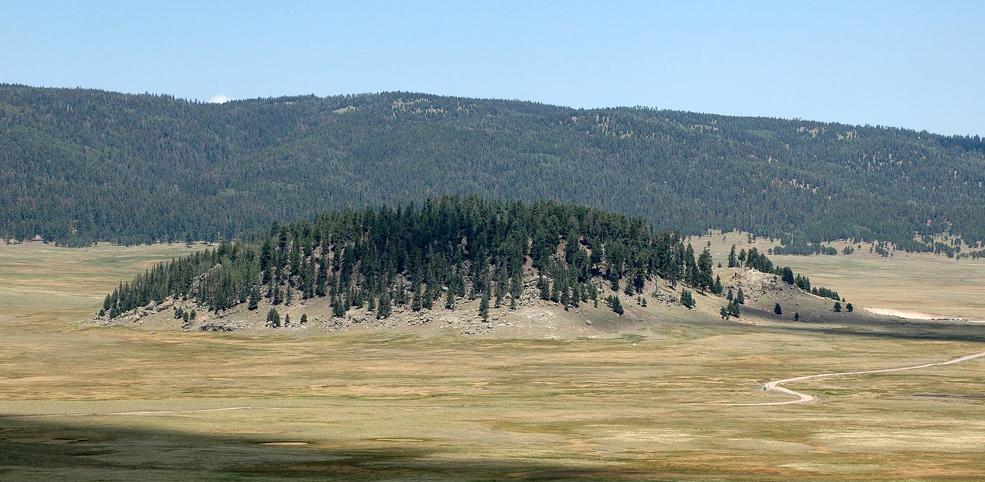
Sources: Jemez Mountain Trail Runs official site and its event info page (date, start times, fees, start/finish, altitude and weather notes, checked November 15, 2026); Wikipedia entries for Los Alamos, Pajarito Mountain Ski Area, Valles Caldera, the Cerro Grande Fire and the Las Conchas Fire (elevations, climate normals, distances and fire history); hero photo by Brian0918 via Wikimedia Commons, public domain. Course layout and runner notes are from past editions and were not verified against a 2027 runner guide, because one isn't published yet. Check the official site before you register or plan.
Some links are Amazon affiliate links. As an Amazon Associate we earn from qualifying purchases, at no extra cost to you.