 AZ Ultra Adventure
On this page
- Cocodona 250 at a glance (2027)
- The course map
- The five worlds of Cocodona
- Every aid station: mile, crew access, drop bags, cutoffs
- The crew guide: a five-day road trip across Arizona
- Sleep stations
- Where poles help
- The finish line is decided here
- Insider knowledge the official site won't spell out
- Watch it before you run it
- Gear and packing list for Cocodona
- The van idea: a crew base camp that drives with you
- Cocodona 250 FAQ
- Who wrote this
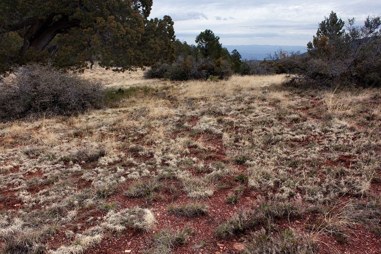
The Cocodona 250 isn't really a trail race. It's a five-day trip across Arizona, run on foot. You start in the saguaros outside Black Canyon City at 2,000 feet and finish under the pines in downtown Flagstaff after 253.5 miles. On the way you cross the Bradshaw Mountains, the old mining town of Crown King, Prescott's Whiskey Row, the Granite Dells, Mingus Mountain, Jerome, the Verde River, Sedona's red rock, the Mogollon Rim and Mount Elden. Aravaipa Running launched it in 2021. It's now one of the most-watched multi-day races in the world, with a livestream that follows the leaders and the last runners alike.
It's also the hardest race in Arizona to crew. Your crew isn't standing at one aid station watching a loop. For four or five days they run a rolling road trip across Yavapai and Coconino counties. They sleep in shifts, drive dirt roads in the dark, and arrive at towns they've never heard of before the runner does. Most guides focus on the runner. This one gives the crew equal weight, because at Cocodona the crew decides more finishes than the website suggests.
A note on sources: the race facts here come from Aravaipa's 2027 Runner Guide, Crew + Pacer Guide and section-by-section course description, all dated October 1, 2026. Insider notes come from crew reports, coach race reports, podcasts and finisher films. Cutoffs and rules change from year to year, so read the official race page and the current guides before race week. Where the official documents contradict each other, this guide says so.
Cocodona 250 at a glance (2027)
| Date | Sunday May 2 to Friday May 7, 2027. 5:00 AM start (the 2025 and 2026 races started on a Monday) |
| Start | Deep Canyon Ranch, Black Canyon City (private land and an active mine: no visits outside race weekend) |
| Finish | Heritage Square, downtown Flagstaff |
| Distance | 253.5 miles (may shift slightly for permits) |
| Elevation | +38,943 ft / −34,039 ft. Low point about 1,996 ft, high point 9,241 ft on Mount Elden |
| Time limit | 125 hours (10:00 AM Friday) |
| Aid | 21 aid stations plus 4 water-only stations |
| Entry | Lottery on racelottery.io (the 2027 draw was June 1, 2026; 475 names pulled plus separate women's and men's waitlists). Extra tickets for past Cocodona finishes and volunteer hours. No qualifier, but a prior 100-miler or similar is strongly recommended |
| Fee | $1,995 to $2,095 depending on registration date, plus tax and UltraSignup fees. Non-refundable; partial credit only if you withdraw early |
| Pacers | From Whiskey Row (mile 75.6). None from Schnebly Hill to Munds Park, and none from Wildcat Hill to the finish |
| Crew | Only at crew-access aid stations. One vehicle per runner, 25 ft max, no trailers |
| Qualifier | Counts as a Western States qualifier (finish inside 125 h), plus ITRA/UTMB points |
| Tracking | Every runner carries a SPOT tracker on TrackLeaders |
Registration runs through UltraSignup, and the lottery rules are on the lottery page. If you want Cocodona-week racing without the full 250, the same week includes the Bradshaw Brute 100 (Black Canyon City to Prescott) and the Sedona Canyons 125 (Jerome to Flagstaff), plus shorter options.
Finish rates by year
| Year | Starters | Finishers | Finish rate |
|---|---|---|---|
| 2021 | 174 | 108 | 62% |
| 2022 | 220 | 151 | 69% |
| 2023 | 193 | 139 | 72% |
| 2024 | 278 | 202 | 72% |
| 2025 | about 291 | about 192-195 | about 66% |
| 2026 | about 396 | about 269 | about 68% |
The 2021-2024 figures are Aravaipa's. The 2025 and 2026 figures are our own count from the TrackLeaders archive, so treat them as close but unofficial. Roughly two out of three starters finish. That's a better rate than many mountain 100s, mostly because 125 hours leaves room to recover from a bad day. That room only helps if you protect it early, which is the point of most of this guide.
The course map
Aravaipa publishes the official course on CalTopo. Export it as a GPX (not the default GeoJSON), load it into Gaia, CalTopo or your watch, and test it in airplane mode before you leave home. Download the file again a few days before the start, because late reroutes do happen.
The official section-by-section course description (PDF) includes an elevation profile for each leg. It's the single most useful document the race publishes. Print it for your crew.
The five worlds of Cocodona
Thinking about the course as one 253-mile line doesn't help much. It's easier as five very different races stitched together.
1. The Bradshaws (miles 0-75): hot, remote, and where the race is lost. The first day is the hardest stretch on the course. After the creek scrambles out of Deep Canyon Ranch, runners fill up to 4 liters at Cottonwood Creek (mile 7.4). Then comes 25.1 miles with about 9,500 feet of climbing on loose, rolling rock to Lane Mountain, with only two 1-liter water stops in between. The Lane Mountain climb gains about 1,500 feet in 2.5 miles and brings you into the pines. Then an easy dirt road drops into Crown King at mile 36.6, the first time you see your crew. After Crown King, runners face the Yankee Doodle Trail climb toward Mount Union, cold nights in the 40s, and confusing forest-road junctions before Prescott. Aravaipa says it may pull runners in the first 30 miles, because an evacuation out there at night is genuinely hard.
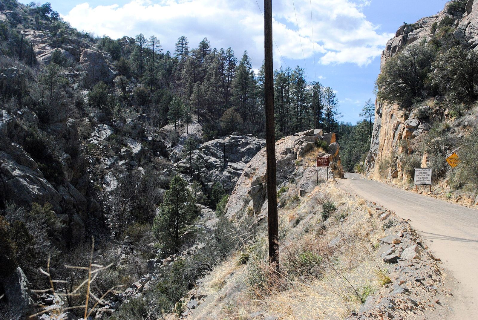
2. Prescott, the Dells and Fain Ranch (miles 75-97): city, slickrock, then cross-country. Whiskey Row is a party. It's the first pacer pickup, with indoor cots in the Grand Highland Hotel and a town full of food. Then the Granite Dells add slickrock and boulder-hopping, and the course drops onto the Peavine rail-trail. After that it gets odd: A-frame ladders over ranch fences and rough cross-country across Fain Ranch. The course description openly warns that this part is unpleasant and hard to navigate. Two separate 2026 leaders lost time with navigation trouble around Prescott.
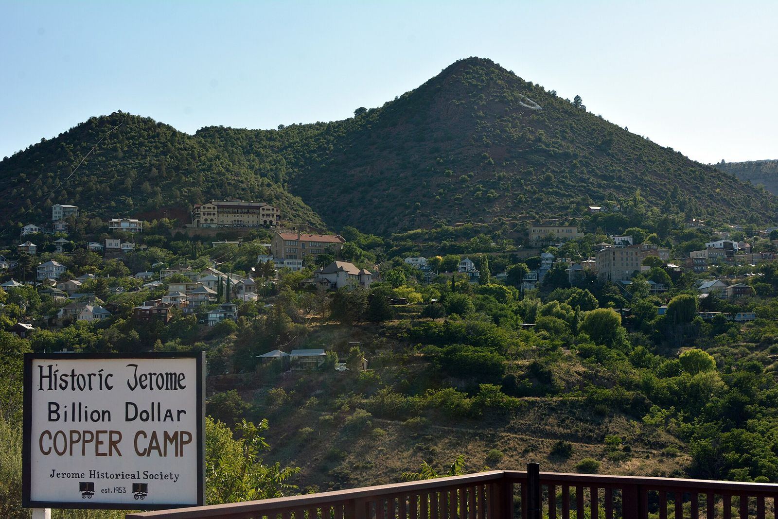
3. Mingus and Jerome (miles 97-124): up 2,800, down 4,400. From Fain Ranch the course climbs the Black Hills on switchbacks to Mingus Mountain Camp at about 7,800 feet. The day-to-night temperature swing here can reach 40°F. Then comes the big drop: 4,428 feet of descent on the technical North Mingus Trail and old mine roads, past the halfway sign, into the hillside town of Jerome. Quads that felt fine at mile 100 are often finished by mile 124.
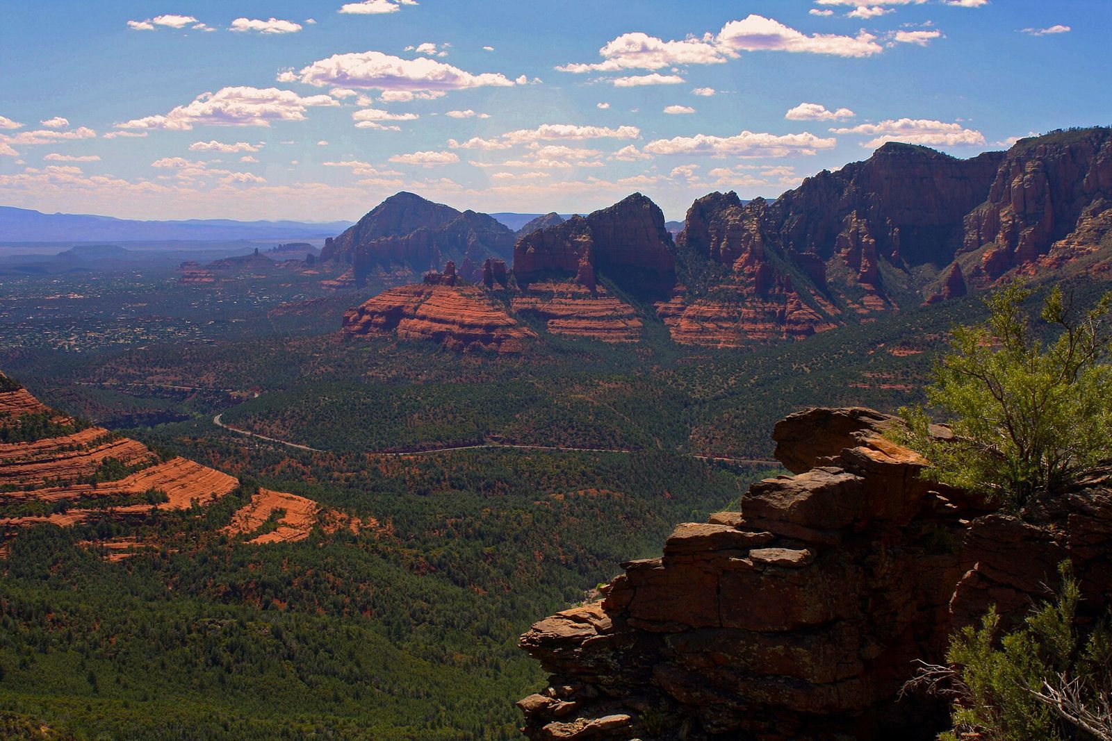
4. Verde Valley and Sedona (miles 124-176): wet feet, dust, heat and red rock. Below Jerome, a steep, loose road drops about 1,000 feet in a mile. Then there's a knee-deep wade across the Verde River, so wet feet are guaranteed. Dead Horse Ranch State Park in Cottonwood follows, then a no-passing zone through endangered-plant habitat and fine dust that works into socks. Daytime temperatures run in the mid-80s. Deer Pass (mile 146.9) has no crew or pacer access, which makes Dead Horse to Sedona a 26.2-mile stretch with no crew. Sedona Posse Grounds (mile 159.1) is a major stop. The next leg is the one many runners call the most beautiful on the course and the one they fear most: Huckaby, Munds Wagon, the exposed slickrock of the Hangover Trail, then the long Schnebly Hill climb onto the Mogollon Rim.
5. The Plateau and Mount Elden (miles 176-253.5): cold, straight, sleepy, and then one last mountain. On top of the Rim the course turns into graded forest roads, pine forest and nights in the upper 30s. This is the sleep-deprivation zone. The course description warns about runners dozing off and waking up in a ditch. Pacers are banned from Schnebly Hill to Munds Park because of Mexican spotted owl habitat. Fort Tuthill (mile 211) adds a mandatory mental-status check. Then the Walnut Canyon rim on the Arizona Trail leads to Wildcat Hill at mile 234.2, where pacers stop for good. Elden is solo: the New Heart Trail climbs gently to a ridge above 9,000 feet, then the Elden Lookout Trail drops about 2,000 feet in 2 miles over roughly 40 steep, technical switchbacks. Night lows near the top run around 25°F, and with wind the chill can feel below zero. After that, Buffalo Park, sidewalks and the Heritage Square finish.
Every aid station: mile, crew access, drop bags, cutoffs
Here's the complete 2027 list from the official Crew + Pacer Guide and course description. Cutoffs are listed as day and time, with the equivalent hours from the 5:00 AM Sunday start. "Pacer" means a pacer can join, swap or leave there.
| Aid station | Mile | To next | Crew | Drop bag | Pacer | Sleep | Cutoff | Notes on the next leg |
|---|---|---|---|---|---|---|---|---|
| Start: Deep Canyon Ranch | 0.0 | 7.4 | Yes | Yes | No | No | Sun 5:00 AM | Black Canyon Trail and dry-waterfall scrambles. 4 L capacity check |
| Cottonwood Creek | 7.4 | 3.0 | No | No | No | No | Sun 9:50 AM (4:50) | Leave carrying 4 L or more. Next full aid is 25.1 mi away |
| Water stop | 10.4 | 14.2 | - | - | - | - | - | Water only, 1 L max. Boulder Creek crossing |
| Water stop | 24.6 | 7.9 | - | - | - | - | - | Water only, 1 L max. Lane Mountain climb (about 1,500 ft in 2.5 mi) begins at mi 28.6 |
| Lane Mountain | 32.5 | 4.1 | No | No | No | No | Sun 10:45 PM (17:45) | Medics here. Easy downhill dirt road into Crown King |
| Crown King | 36.6 | 14.4 | Yes (first) | Yes (same bag goes on to Fort Tuthill) | No | No | Sun 11:55 PM (18:55) | Gear check. Next crew is 39 mi away. Wagoner Trail, Senator Hwy |
| Arrastra Creek | 51.0 | 9.8 | No | No | No | No | Mon 7:00 AM (26:00) | Yankee Doodle Trail climb toward Mt Union, steep and loose. Poles |
| Kamp Kipa | 60.8 | 6.6 | No | Yes | No | Indoor heated bunks | Mon 2:00 PM (33:00) | Confusing dirt-road junctions. Groom Creek Trail |
| Camp Wamatochick | 67.4 | 8.2 | No | Yes | No | Indoor bunks + showers | Mon 4:45 PM (35:45) | Goldwater Lake singletrack, 2.5 mi pavement into Prescott. Owl area: keep quiet |
| Whiskey Row (Prescott) | 75.6 | 7.2 | Yes | Yes | Yes (first pickup) | Indoor cots | Mon 10:00 PM (41:00) | Sidewalks, Watson Woods, Peavine Trail |
| Watson Lake | 82.8 | 13.7 | Yes ($5 parking) | No | Yes | No | Tue 3:30 AM (46:30) | Granite Dells slickrock, fence ladders, cross-country across Fain Ranch |
| Fain Ranch (Prescott Valley) | 96.5 | 10.7 | Yes | Yes | Yes | No | Tue 6:00 AM (49:00)* | Gear check. Rough cross-country, then switchbacks up to Mingus (+2,790 ft) |
| Mingus Mountain Camp | 107.2 | 17.0 | Yes (dogs stay in cars) | Yes | Yes | Indoor bunks + hot showers | Tue 1:00 PM (56:00) | 17 miles, 4,428 ft of descent to Jerome. Technical |
| Jerome | 124.2 | 8.7 | Yes (no pacer parking) | No | Yes | No | Tue 8:30 PM (63:30) | Steep loose road down, Clarkdale, Verde River wade |
| Dead Horse Ranch SP (Cottonwood) | 132.9 | 14.0 | Yes (no pacer parking) | Yes | Yes | Outdoor tents + showers | Wed 12:00 AM (67:00) | No-passing zone, Lower Raptor, Thumper, Lime Kiln. Fine dust |
| Deer Pass | 146.9 | 6.7 | No | Yes | No | No | Wed 4:45 AM (71:45) | Skywalker, Ridge and Bandit trails. Can be very hot |
| Water stop | 153.6 | 5.5 | - | - | - | - | - | Water only, near Red Rock High School |
| Sedona Posse Grounds | 159.1 | 11.3 | Yes | Yes | Yes | Indoor cots | Wed 12:00 PM (79:00) | Gear check. Hangover Trail slickrock, Schnebly Hill climb (+3,566 ft to Schnebly). Poles |
| Water stop | 170.4 | 5.3 | - | - | - | - | - | Water only on Schnebly Hill Road |
| Schnebly Hill (I-17 exit 320) | 175.7 | 14.4 | Yes | Yes | Pacers stop | No | Wed 9:00 PM (88:00) | Graded forest roads, owl habitat: no pacers to Munds Park |
| Munds Park | 190.1 | 12.7 | Yes | Yes | Yes (rejoin) | Outdoor unheated tents | Thu 2:45 AM (93:45) | Gear check. Kelly Canyon trails. Nights in the upper 30s |
| Kelly Canyon | 202.8 | 8.3 | No | No | No | No | Thu 8:00 AM (99:00) | Bare-bones. FR700, Old Munds Hwy, Highland Trail. Hwy 89A crossing has no traffic control |
| Fort Tuthill (Flagstaff) | 211.1 | 16.1 | Yes (drive into the quad) | Yes (your Crown King bag) | Yes | Indoor heated cots | Thu 12:45 PM (103:45) | Gear check + mental-status evaluation. Flagstaff Loop Trail, Fisher Point, Walnut Canyon rim |
| Walnut Canyon | 227.2 | 7.0 | Yes (very limited parking) | Yes | Yes | No | Thu 7:45 PM (110:45) | Double-track, under I-40, Tom Moody Loop |
| Wildcat Hill | 234.2 | 15.3 | Yes (no pacer parking) | Yes | Pacers stop | No | Thu 10:45 PM (113:45) | Gear check. Mount Elden: +3,386 / −3,055 ft, solo |
| Trinity Heights | 249.5 | 4.0 | No | No | No | No | Fri 8:15 AM (123:15) | Pipeline Trail to Buffalo Park; crew and family can walk in from Buffalo Park |
| Finish: Heritage Square | 253.5 | - | Yes | All bags | - | - | Fri 10:00 AM (125:00) |
*The published 2027 cutoffs for Watson Lake (Tue 3:30 AM) and Fain Ranch (Tue 6:00 AM) leave only 2.5 hours for 13.7 hard miles. That looks like a typo in the table. Confirm both with the race at the briefing.
What the table means in practice:
- Your crew sees you only twice in the first 75 miles: at the start and at Crown King. Crown King to Whiskey Row is 39 miles with drop bags at Kamp Kipa and Wamatochick and no crew access. The first day is a self-supported race.
- Drop bags: 60 liters max, labeled with bib number and station name only. One bag covers both Crown King and Fort Tuthill, because the race forwards it. Put your Crown King "night kit" in it, and anything you'll want again on the cold Flagstaff end. Bags get no cover from rain or sun, so use a waterproof bin or a dry bag.
- No drop bags at Watson Lake or Jerome. Your crew is your drop bag there.
- Hot food at almost every full aid station. Past menus included pulled pork and potato soup at Crown King, lasagna and pizza at Mingus, and burgers at Sedona and Wildcat Hill. Water stops are water only, 1 liter each.
- Gear checks at the start (4 L capacity), Cottonwood Creek (4 L carried), Crown King, Fain Ranch, Sedona Posse Grounds, Munds Park, Fort Tuthill and Wildcat Hill. Cold-weather gear (gloves, warm hat, long sleeve, insulating layer) gets checked at the cold-weather stops. A waterproof hooded jacket is required when rain or snow is in the forecast. In 2025, hail and freezing rain hit the Bradshaws before jackets were required. Carry one anyway.
- An IV anywhere means an automatic DNF.
The crew guide: a five-day road trip across Arizona
This is the part that matters most to crews, so it's laid out in driving order. Aravaipa's official position is that every crew point can be reached in a normal passenger car, and that the Crown King and Walnut Canyon roads are rough but fine for "a competent rough road driver." That matches what crews report, with one important caveat about time.
The rules your crew must know
- Crew only at crew-access aid stations, within a quarter mile. No parking along the course, no "meeting on the trail."
- One crew vehicle per runner at each aid station. 25 feet max, no trailers. A trick from a 2026 crew report: pacers park nearby and ride in with the crew vehicle.
- Crown King needs a parking pass, and you get it at Bumble Bee Ranch first. Bumble Bee is not an aid station. It's the crew holding area, with the livestream on TVs, food and shade.
- Two roads are off-limits to crews: Senator Highway from Crown King to Prescott, and Schnebly Hill Road up from Sedona. Both look like shortcuts on a map, and the race bans both.
- Pacer parking is banned at Jerome, Dead Horse and Wildcat Hill, with alternatives below.
- Leaving the course to sleep in a hotel, van or rental is allowed, but only from a crew-access aid station. The runner checks out with the aid station captain and hands in the bib and SPOT tracker. They must restart from the same station before its cutoff or before the sweeps arrive, whichever comes first. A crew vehicle parked within a quarter mile of the station counts as on course, which is a big reason a sleep-capable crew vehicle helps here.
- Crew and off-duty pacers can't eat aid station food. Bring your own.
- Emergency text line (text only): (602) 830-4526, with bib, location and the problem. Save it in every crew phone.
Leg by leg
The three drive times Aravaipa publishes are marked "official." Everything else is our own estimate from mapping the routes. Add a margin, because you'll be tired and it'll be dark.
| Crew move | Drive time | Road / parking notes |
|---|---|---|
| Phoenix / Anthem → Start (Deep Canyon Ranch) | about 45-60 min from north Phoenix | Gate, creek crossing into a field, 15 mph inside. Long-term parking at the start |
| Start → Bumble Bee Ranch | about 30 min (official) | Check in first for your Crown King parking pass. Paid camping by reservation |
| Bumble Bee → Crown King (mi 36.6) | about 1 hr (official); one 2026 crew needed 90 min in a low 2WD van | Bumble Bee / Crown King Road: a long, rough, mostly dirt mountain road with tight curves. Don't follow your phone's "faster" route. Very limited parking, pass required. Crew from any space in town. The General Store has gas, food and ice |
| Crown King → Whiskey Row (mi 75.6) | about 2 hr (official) | Back down to I-17 and up through Cordes Junction, NOT Senator Hwy. Parking garage at 135 S Granite St (7'10" clearance; tall vans won't fit) |
| Whiskey Row → Watson Lake (mi 82.8) | about 10-15 min | $5 per car; overnight cars need a printed pass. Pacers stay out of the upper lot |
| Watson Lake → Fain Ranch (mi 96.5) | about 20 min | Living Waters Church, Prescott Valley; use the far back left corner of the lot |
| Fain Ranch → Mingus Mountain Camp (mi 107.2) | about 35-45 min | Hwy 89A over the pass, right at the summit onto FR104, 2.3 mi. Dogs must stay in vehicles |
| Mingus → Jerome (mi 124.2) | about 25-35 min | Narrow, busy town. Never park in residential areas. Pacers use the lot at 1350 Jerome-Perkinsville Rd |
| Jerome → Dead Horse Ranch SP (mi 132.9) | about 20 min | First left in the park to the Raven group site. Pacers park at the dirt lot by the Cottonwood dog park on 10th St (0.7 mi) |
| Dead Horse → Sedona Posse Grounds (mi 159.1) | about 30-40 min | No crew at Deer Pass, so this is your crew's longest break on the back half. Stay right past the entrance; big lot on the left |
| Sedona → Schnebly Hill (mi 175.7) | about 45-60 min | SR 179 to I-17 north, exit 320, west 0.6 mi on FR153, left, park on the right. NOT up Schnebly Hill Road from Sedona |
| Schnebly Hill → Munds Park (mi 190.1) | about 10 min | I-17 exit 322, left into the temporary storage lot. Never the church lot. Pacers use the dirt lot by the gas station |
| Munds Park → Fort Tuthill (mi 211.1) | about 20 min | Follow signs for Adventure X and drive into the quad; crewing from the parking lot isn't allowed |
| Fort Tuthill → Walnut Canyon (mi 227.2) | about 25-30 min | I-40 east to the Walnut Canyon exit (not Country Club). The last mile is rough and parking is tiny: arrive when your runner is close, leave soon after |
| Walnut Canyon → Wildcat Hill (mi 234.2) | about 20 min | Water treatment plant on El Paso Rd. Pacers park at the Picture Canyon trailhead |
| Wildcat Hill → Finish | about 15 min | Free crew parking at 625 E Cherry Ave (0.6 mi walk) with a free hourly shuttle. Check the shuttle days in the final guide; they're inconsistent in the current one |
Full addresses and GPS coordinates for every stop are in the official Crew + Pacer Guide. A 2026 crew report in Believe in the Run recommends a single shared crew document with every station pinned in Google Maps. Some stations only have coordinates, which is hard to work from at 3 AM.
Cell signal
Aravaipa calls coverage along the course very good. Crews need data to follow the SPOT tracker, but runners don't need signal for it. We couldn't independently confirm coverage around Crown King and the Bradshaws, so download offline maps for the whole route and screenshot the cutoff table before you leave Phoenix.
When to sleep (the crew's, not the runner's)
The official guide suggests that crews of mid-pack and back-of-pack runners camp at Bumble Bee after Crown King and still reach Whiskey Row in time. Crews of faster runners shouldn't, or they'll miss Prescott. With the 2027 Sunday start, Crown King happens Sunday evening into the night, so that crew sleep falls on Sunday night. The big crew break on the back half is the Dead Horse to Sedona stretch, 26.2 miles with no crew access. Use it.
Recurring crew advice from reports:
- Don't burn out everyone on day one. Assign a crew chief who gets protected sleep.
- Space pacer shifts about 24 hours apart so nobody paces two nights in a row.
- Recalculate ETAs from real splits. Runners can get hours ahead of plan, and crews that assumed a fixed pace have missed them.
- Book a cheap bed or two: Prescott, Cottonwood and Flagstaff for the crew, plus a hotel near the start the night before. Hotels sit near the stations at Whiskey Row (you can book a room in the Grand Highland upstairs from the aid station), Jerome, Dead Horse, Sedona and Munds Park (Motel in the Pines is right on course).
- Free dispersed camping the guide points to: Crown King Road and Bloody Basin Road, Senator Highway past Groom Creek, FR413 near Mingus (drive slowly; it's course), Bill Gray Road north of Cottonwood, Loy Butte Road and FR535 near Sedona, and Schnebly Hill Road / FR226 off I-17.
- Every time the runner leaves the crew, check for three things: the SPOT tracker, car keys and a card. Runners do leave without their tracker after a pack swap, and the rule is that you go back for it.
Sleep stations
Cocodona is where many people learn to sleep on purpose during a race. These are the runner-only sleep options (bring your own liner or light bag):
| Station | Mile | Sleep setup | Crew there? |
|---|---|---|---|
| Kamp Kipa | 60.8 | Indoor heated bunks, few blankets | No |
| Camp Wamatochick | 67.4 | Indoor heated bunks, showers | No |
| Whiskey Row | 75.6 | Indoor heated cots (hotel ballroom) | Yes |
| Mingus Mountain Camp | 107.2 | Indoor heated bunks, hot showers | Yes |
| Dead Horse Ranch | 132.9 | Outdoor unheated tents with cots, showers | Yes |
| Sedona Posse Grounds | 159.1 | Indoor heated cots | Yes |
| Munds Park | 190.1 | Outdoor unheated tents with cots | Yes |
| Fort Tuthill | 211.1 | Indoor heated cots | Yes |
What finishers say about sleep, paraphrased from an Aravaipa sleep article by Jeff Garmire, a coach's race report on Team RunRun, and a 2026 crew report:
- The first night arrives sooner than you expect after the Bradshaw climbing. Many runners push through night one moving with a group.
- Short sleeps work best. 20-minute power naps or 90-minute single sleep cycles beat lying awake on a cot for three hours.
- Bunk rooms next to a busy kitchen are loud. Several runners slept far better in the back of the crew vehicle than in the official sleep tent.
- A small wake-up ritual, like brushing your teeth, changing your shirt and eating something warm, helps reset the brain.
- If you lie down on the trail, point your poles toward the finish so you set off the right way when you wake. The official guide says this, and it's not a joke.
- Hallucinations usually start in the later stages, north of Sedona. Expect them, stay calm, and check the GPS more often.
Where poles help
Poles are on Aravaipa's recommended-gear list, and the course description names the sections where they help most. There are crew or drop-bag points before every big climb, so you can manage poles deliberately:
- From the start through Crown King. The 9,500 feet of climbing on loose rock to Lane Mountain is where poles do the most work. Start with them.
- Arrastra Creek to Kamp Kipa, the Yankee Doodle Trail climb toward Mount Union. Poles are already with you from Crown King.
- Fain Ranch to Mingus. About 2,800 feet of climbing with a 4,400-foot technical descent right after. Poles help on the climb and save your knees on the way down to Jerome.
- Sedona Posse Grounds to Schnebly Hill. The race specifically recommends poles here. Stow them on the Hangover slickrock if you need your hands, then use them for the Schnebly Road grind.
- Wildcat Hill to the finish: Mount Elden. Solo and at night for most runners. The 40 switchbacks down the Elden Lookout Trail are steep with big step-downs, and tired legs on that descent are where poles pay off most.
The flat-ish Prescott sidewalks, the Peavine rail-trail and the Plateau roads after Schnebly Hill are where you can hand poles to crew and give your shoulders a break. Pick them back up at Wildcat Hill. Fort Tuthill is also an easy swap point, since your Crown King drop bag shows up again there.
The finish line is decided here
The SPOT tracker archive shows where people stop. We grouped the 2026 DNFs by the last mile each tracker reported, which is approximate because a tracker can lag the actual drop. The patterns are clear:
- Fain Ranch and Mingus (miles 90-110) took a large share of drops in both 2025 and 2026. A notable 2026 front-runner stopped at Fain Ranch, and in 2025 Courtney Dauwalter dropped at Mingus. Runners arrive here on their second night, after Prescott's town comforts, facing the cross-country and the big climb.
- Jerome to Deer Pass (miles 124-147) was the biggest cluster in 2026, with Dead Horse Ranch alone accounting for a dozen. Trashed quads from the Mingus descent, wet feet from the Verde wade, heat in the valley, and then the longest no-crew stretch of the back half.
- Schnebly Hill (mile 176) and Munds Park to Kelly Canyon (miles 190-209): the Sedona climb, then the cold, sleepy Plateau nights without a pacer.
The early race (the Bradshaws) produces fewer drops in raw numbers but sets up most of the later ones. Coaches and finishers keep repeating the same point: the runners who blow up at Mingus or Dead Horse usually spent too much in the heat before Lane Mountain on day one. Several runners who started fast had to drop, and one runner in a 2023 coach report collapsed in the heat between Dead Horse and Deer Pass and needed hours of rest and electrolytes to continue.
The line to get past is Sedona Posse Grounds. If you leave Sedona with a working stomach, your cold-weather kit and the Schnebly climb ahead of you in daylight or early evening, the hard decisions are mostly behind you. The Plateau is long and cold, but it's mostly runnable roads with crew access every 10-20 miles. Then get past Fort Tuthill's mental-status check, because a runner who fails it must sleep there until they pass. By then the course is down to Walnut Canyon, Elden and the walk into town.
How not to DNF at Cocodona
- Treat day one like a hot 50K that you must finish fresh. Carry more than the required 4 liters if you drink a lot, consider a filter flask, take electrolytes early, and wear real sun protection. Hike every climb to Lane Mountain.
- Fix problems at crew stops, not later. The official advice is to deal with foot problems at Crown King. With 39 miles to the next crew, a hot spot at mile 40 is a blister by Prescott.
- Sock change and foot wipe every 20-30 miles. Dry your feet properly after the Verde River and before the Dead Horse dust. One runner in a coach report called going up half a shoe size around mile 78 the best decision of the race.
- Have a chair rule. At major stations, set a timer: 10 minutes for a normal stop, a planned sleep or nothing. Crews should say "what do you need, here it is, let's go," not "how are you feeling?"
- Plan the second night (Fain Ranch to Mingus) like a separate race. Have a pacer, a warm jacket, caffeine timing and hot food ready at Fain Ranch. This is a classic place to quit.
- Use the 125 hours. Finishers' reports describe sleeping on purpose and early enough, in short planned blocks, instead of waiting until they collapse. A 90-minute sleep at Mingus or Sedona can turn a death march into a finish.
- Respect the cold on the back half. Runners leave Sedona sweating and reach the Rim shivering. Munds Park and Elden at night can drop to 25°F with wind. Carry the gloves and puffy, not just in the drop bag.
- "Just get to the next aid station." No station on this course is more than 25 miles from the last, and most of the back half is under 15. Crews: tell the runner the next station's name and its hot food, not the miles left to Flagstaff.
- Crews: keep spirits up with real things. Fresh socks, a cold drink, messages from friends read aloud, the livestream chat. Not a lecture about pace.
A sober note: a participant died after a medical emergency during the 2026 race. The organizers didn't release details. Use the medics at stations marked for them, take heat and confusion seriously, and remember that an IV ends your race but treats the problem.
Insider knowledge the official site won't spell out
We looked for Cocodona threads on r/ultrarunning and r/trailrunning and found surprisingly little race-specific discussion that we could verify. Most of the real knowledge lives in crew reports, coach race reports, podcasts and finisher films. The useful bits, paraphrased:
- The early race is gear-heavy. Finn Melanson pointed out in an interview with GORE that you see crew only twice in the first 80 miles. Pack a vest for 15-25 hours without help.
- Don't trust a nap at a loud aid station (2026 crew report). Treat the crew vehicle as the bedroom.
- The Crown King drive takes longer than you think. It's the most common crew mistake named in reports, with the 90-minute figure from 2026.
- Talkative pacers keep runners awake. One coach's runner fell asleep while moving on night one and saw imaginary aid stations in the trees on the climb to Mingus.
- Elden was harder than expected for several runners in past editions, with rocks and occasional late snow patches, at the point when you have no pacer.
- Deer Pass lost crew access in 2026. A course-preview podcast flagged that this lengthens the Verde-to-Sedona stretch, so plan bottles and food for a longer gap.
- Budget. An UltraRunning article on budgeting for Cocodona is a good reality check. Between entry, five nights of crew lodging, gas and food, the race costs far more than the bib.
- Leader drama is part of the story. In 2026 Rachel Entrekin won outright in a course-record 56:09:48, the first woman to win Cocodona outright, and Kilian Korth set the men's record at 57:28:36. Navigation mistakes near Prescott cost two top women time. For context, the 2021 winning time was 72:50:25, so the front of the race has sped up by more than 16 hours in five editions.
Worth reading before the race: the Believe in the Run crew report, Coach Des Clarke's race report on Team RunRun, and Aravaipa's article on the sleep-deprivation puzzle.
Watch it before you run it
Aravaipa's films are some of the best preparation there is. You see the actual trail, aid stations and night sections.
Gear and packing list for Cocodona
Required on the whole course: phone, a GPS device with the course loaded plus a way to charge it, headlamp with spare power, collapsible cup (the race is cupless), space blanket and whistle. Cold-weather kit is checked at the high stations. These are the gear picks that matter on this specific course:
- Trekking poles. Lightweight folding carbon poles that fit in a vest quiver, for the Bradshaws, Mingus, Schnebly and Elden. Folding carbon trail running poles
- A vest that really carries 4 liters. The rule is to leave Cottonwood Creek carrying 4 L. Most race vests hold 1-1.5 L in front flasks, so add a bladder. 12L running vest with bladder
- A filter flask for the long dry miles before Lane Mountain, as Aravaipa suggests. Filter soft flask
- A bright, rechargeable headlamp plus a power bank. Four or more nights, and the Elden switchbacks. Rechargeable running headlamp and a slim 10,000 mAh power bank
- Sun hoodie and sun gloves for day one and the Verde and Sedona afternoons. UPF sun hoodie
- Gaiters for cholla, gravel and the Dead Horse dust. Trail running gaiters
- Toe socks and a real foot kit. Injinji trail toe socks, anti-chafe balm, and a small blister kit.
- Electrolytes, taken early and often in the heat. Electrolyte capsules
- Sleep kit: a liner for the cots and earplugs plus an eye mask for loud stations. Sleeping bag liner and earplugs and sleep mask set
- For the crew: a reclining camp chair for the runner (and a timer on it), plus a big cooler for ice. Zero gravity camp chair
Also bring a comb for pulling cholla spines out of skin (the race really recommends one for the first 30 miles), a light waterproof jacket even when it isn't required, and a cheap insulated bottle for hot broth on the Plateau.
The van idea: a crew base camp that drives with you
Cocodona is the race AZ Ultra Vans was imagined for. A 250-mile point-to-point with five days of crewing turns any crew car into a mobile aid station, kitchen and bedroom. The official rules make a sleep-capable crew vehicle extra useful: a crew vehicle parked within a quarter mile of a crew-access aid station counts as on course. Your runner can take a real 90-minute sleep in a real bed instead of a loud cot, then step back out onto the trail.
What a race van means at Cocodona: shade in the Verde Valley afternoon, a fridge for cold drinks and real food, ice for the heat, a bed for whoever is off shift, power to charge headlamps and phones, room for the drop bin, and compression boots at Sedona. Whatever you crew from, check it against the race's 25-foot vehicle limit, and note that the Whiskey Row parking garage has a 7'10" clearance, so tall vans need a lot or street parking in Prescott.
AZ Ultra Vans is still at the reservation-interest stage. Joining the list tells us which races to plan around, and it isn't a booking or a promise of availability. If you've been picked for Cocodona and want a van in May, add your name on the reservation card in the crew section above.
Cocodona 250 FAQ
When is the 2027 Cocodona 250? Sunday May 2 to Friday May 7, 2027, with a 5:00 AM start at Deep Canyon Ranch in Black Canyon City and a 125-hour limit (10:00 AM Friday) at Heritage Square in Flagstaff.
How do you get into Cocodona? Through a lottery that usually opens in May for the following year. The 2027 draw was held June 1, 2026, with 475 names pulled plus waitlists. Past Cocodona finishes and volunteer hours earn extra tickets, and the lottery includes a gender-equity boost for women. Charity entries exist through the race's charity partner.
How many aid stations does Cocodona have, and how many have crew access? 21 aid stations plus 4 water-only stops. Crews can meet runners at the start, Crown King, Whiskey Row, Watson Lake, Fain Ranch, Mingus, Jerome, Dead Horse Ranch, Sedona Posse Grounds, Schnebly Hill, Munds Park, Fort Tuthill, Walnut Canyon, Wildcat Hill and the finish. Cottonwood Creek, Lane Mountain, Arrastra Creek, Kamp Kipa, Camp Wamatochick, Deer Pass, Kelly Canyon and Trinity Heights are runner-only.
Do you need a 4x4 to crew Cocodona? No. Aravaipa says every crew point is reachable in a passenger car. Crown King Road is long, rocky and slow, and the last mile to Walnut Canyon is rough, so drive carefully and allow extra time (about 1 to 1.5 hours from Bumble Bee to Crown King). Senator Highway and Schnebly Hill Road from Sedona are off-limits to crews.
Where can pacers join at Cocodona? From Whiskey Row in Prescott (mile 75.6) at any pacer-access station. There are two no-pacer sections for owl habitat: Schnebly Hill to Munds Park, and Wildcat Hill to the finish (the Mount Elden climb). Pacers carry the same required gear and may not carry anything for the runner.
How much do Cocodona runners sleep? It varies widely, but most finishers rely on several short sleeps of 20 to 90 minutes rather than one long one. There are eight official sleep stations, from Kamp Kipa (mile 60.8) to Fort Tuthill (mile 211.1). Many runners sleep better in their crew vehicle.
What's the hardest part of Cocodona? Day one. The 25.1 miles from Cottonwood Creek to Lane Mountain gain about 9,500 feet on loose rock in the heat, and runners have no crew until Crown King at mile 36.6. Later, the second night from Fain Ranch over Mingus and the Mingus-to-Jerome descent are where many races fall apart. Mount Elden, climbed solo near the end, is the last real test.
Is Cocodona a Western States qualifier? Yes. A finish within the 125-hour limit counts as a Western States qualifier, and the race also carries ITRA and UTMB points.
Who wrote this
Johnathon Lawson is a trail runner from Gilbert, Arizona, and the person behind AZ Ultra Adventure. He has finished the Mogollon Monster 100 (an Aravaipa race on the Mogollon Rim), the San Diego 100 and the Zion 100. He hasn't run Cocodona. This guide was built as a researcher and crew planner, from Aravaipa's 2027 runner and crew guides, results archives, crew reports and finisher films. Corrections from Cocodona finishers and crews are welcome through the site.
Follow along on Strava, YouTube and Instagram.
Some links are Amazon affiliate links. As an Amazon Associate we earn from qualifying purchases, at no extra cost to you.