 AZ Ultra Adventure
On this page
- The 2027 numbers
- Getting in, and what it costs
- What's different from the race reports you've read
- The map
- The loop in five acts
- Every aid station
- The clock
- Sleep: five stations, six hours
- Crew guide: mile 16.8, then a very long wait
- Pacers: six legs, and the first one is 46 miles
- Water: where there is some, where there's none
- Where poles help, and where to carry them
- What runners and pacers say that the manual doesn't
- The finish line is decided here
- Gear for this course
- The van idea
- Moab 240 FAQ
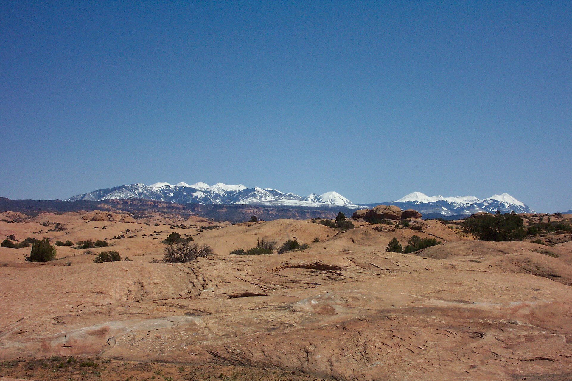
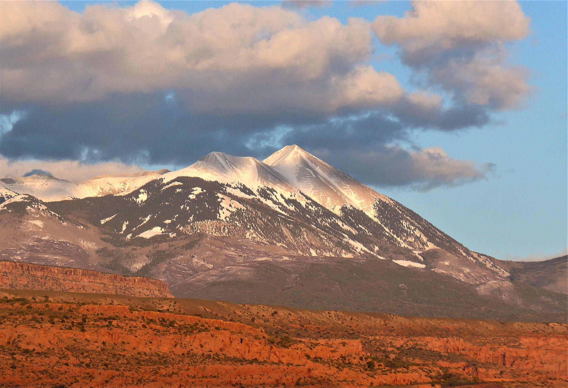
The Moab 240 is one loop. Not laps, not an out-and-back, not a point-to-point with a bus ride: a single 241.8-mile circle that leaves Moab heading south above the Colorado River, crosses Lockhart Basin with Canyonlands off to the west, climbs over the Abajo Mountains above 10,500 feet, comes back north on gravel roads, climbs again into the La Sals, and drops down Porcupine Rim to the same RV park it left four days earlier.
It was created in 2017 in memory of Stephen Jones, a 200-mile pioneer who first imagined a single-loop 200-miler starting and finishing in Moab, and who died in an avalanche in early 2016. The race and his family set up an internship scholarship in his name at Utah State University.
And in October 2026 nobody finished it. A storm reached the course on Saturday, October 10. Flooding stranded at least 70 runners and volunteers near Bridger Jack; they spent the night in heated tents and were bused out Sunday morning, according to KSL. On Sunday afternoon, about 55 hours in, the organizer, Destination Trail, called the race, citing wind, rain, freezing temperatures, falling trees and aid station structures blowing away. UltraSignup lists the 2026 results by distance covered, with the leader at mile 204.4, less than 40 miles from home. The official race page says those marks aren't eligible for course records.
So 2027 is a comeback year, on a clock about five hours shorter than the one the 2025 field ran under. This guide is built for that edition.
I haven't run the Moab 240, and my own finishes top out at 100 miles. This is a researcher's and crew chief's guide, built from the 2027 runner manual, the official race page, UltraSignup results, runner reports and news coverage. Where the manual disagrees with itself, I say so.
The 2027 numbers
- Dates: Friday, October 8, 2027, 6:00 AM, through Tuesday, October 12, 10:00 PM.
- Time limit: 112 hours (4 days, 16 hours). The clock never stops.
- Distance: 241.8 miles, one loop.
- Climbing: 31,696 feet of gain on the race page and in the manual's segment table (another paragraph of the same manual says about 31,564). High point is a little over 10,500 feet in the Abajos.
- Start/finish and headquarters: Sun Outdoors Arches Gateway, 1773 N Highway 191, Moab, UT 84532. Older reports call it Moab Valley RV Resort. It's the same property under a newer name.
- Organizer: Destination Trail, the same company behind the Arizona Monster 300, Tahoe 200 and Bigfoot 200.
- Aid: 15 full aid stations, five of them sleep stations, plus one self-serve water stop.
- Check-in: Thursday, October 7, 1:00 to 3:30 PM only, with a medical check, a mandatory gear check, and a GPS check (you show the course track on a device and prove you can use it). Drop bags are due by 5:00 PM. The mandatory runner meeting is 4:00 to 5:00 PM at Lions Park, across the highway.
- Race morning: tracker pickup 4:30 to 5:30 AM at the start, per the manual's calendar (a later section still says 9:00 to 11:30 AM, which can't be right for a 6:00 AM start).
- Minimum age: 18.
- Official pages: race page, 2027 runner manual, 2026 results on UltraSignup.
A note for Arizona crews: Moab is on Mountain Daylight Time in early October, one hour ahead of Phoenix. The 6:00 AM start is 5:00 AM on a phone still thinking in Arizona time. The drive from the Phoenix area is roughly seven and a half to eight hours (we haven't timed it).
Getting in, and what it costs
Entry is by lottery. For 2027 the race page lists:
- Lottery opens: January 5, 2027, 8:00 AM MST
- Lottery closes: January 24, 2027, 11:59 PM MST
- Drawing: January 26, 2027, 10:00 AM MST
The 2027 manual does not list a qualifying race. It lists an age minimum and a long description of the experience you should have: ultra distance background, fastpacking experience, comfort carrying a heavy pack through heat and cold. Check the lottery page when it opens in case a requirement is added.
The fee is $1,795, plus UltraSignup's fees. That's the figure in the manual's refund policy, and the organizer's payment-plan sheet adds up to the same number. The plan is $995 down plus a $100 plan fee, then four payments of $200 at 30-day intervals. It has to be arranged by email before you enter the lottery. The same sheet says nothing is charged when you register for the lottery; the card is charged if you're drawn.
There is a second door. Destination Trail sells the Triple Crown of 200s (Tahoe 200, Bigfoot 200, Moab 240) and a four-race Grand Slam (add the Arizona Monster 300) as bundles that skip the individual lotteries. The series pages list savings of $300 and $1,085. The catch is timing: the series registration page on UltraSignup describes a window of May 1 to 31 each year, with a higher-priced waitlist after that. For the 2027 series that window was May 2026. If you missed it, the January lottery is the way in. Check the Triple Crown and Grand Slam pages for current status.
Read the refund policy before you enter. The short version: 50% refund or 75% transfer credit before July 1, less in July, a 25% transfer only in August, nothing after August 31. No runner-to-runner transfers. And the line that matters after 2026: if the race is cancelled in September or October, or stopped mid-run, the manual says there is no transfer credit. Volunteering can earn entry credit; the manual gives a contact for it.
Western States qualifier: yes, with a catch. The Western States qualifying-race list includes the October 2027 Moab race for the 2028 lottery, with a qualifying time of 108 hours. That's four hours inside the race's own limit, so a finish in the last four hours earns a buckle but not a qualifier. For the stopped 2026 race, the same list says runners who reached The Island checkpoint at mile 82 qualify for the 2027 lottery.
What's different from the race reports you've read
The clock. UltraSignup's 2025 results run out to a last finisher at 116:46:20, which fits the 117-hour limit secondary sources give for that year. The 2026 listing dropped it to 112 hours, and the 2027 manual holds it there. That matters more than it sounds: in 2025, 38 of the 149 finishers, one in four, came in after the 112-hour mark. Course details have shifted between editions, so it isn't a like-for-like comparison, but discount any advice about banking long sleeps.
The mile numbers. A 2020 interview puts Indian Creek at mile 72, and a 2021 report puts the top of the Shay Mountain climb at mile 120. The 2027 manual has them at 67.8 and 114.2, and it has two stations, Monticello Lake and The Needles, that none of the older reports we read mention. Translate old advice by station name, not by mile.
Indian Creek is no longer a crew stop. The 2020 finisher met his crew there, and a 2021 account has a crew waiting at the mile-72 station. The 2027 manual makes Indian Creek pacer drop-off only. That one change is why the crew gap described below is so long.
Course changes can happen late. In 2026, a reroute around Highway 128 construction on September 24, two weeks before the start, added 1.7 miles and an hour to the limit, according to multidayrunning.com's summary of that year's manual. In 2021, organizers moved the high sections lower ahead of a snowstorm; a Team RunRun report and Go Gnarly's account of the winner's race both describe it. The manual reserves the right to change the route mid-race.
The map
Destination Trail publishes the course on CalTopo, with downloadable GPX and KML. Carrying the GPX track on a device is mandatory. The manual recommends Gaia on a phone and warns that CalTopo's own measurements read short compared with the manual's mileages.
One thing to know: when we checked in mid-November 2026, the finish marker on that map still showed the rerouted 2026 cutoff of Tuesday 11:00 PM. The 2027 manual says 10:00 PM. Go by the manual, and download the GPX again shortly before race week.
The manual also names two paper maps that cover the course: Latitude 40's Moab East and Moab West.
The loop in five acts
Act 1: Rock and river (start to Base Camp, miles 0 to 29.1)
A dark start, a few miles of bike path and neighborhood streets, then singletrack to Hidden Valley at 8.3. Right after that aid comes a 0.6-mile, 550-foot scramble where the manual says you may need both hands. Then meadow, slickrock, and a steep technical drop off the Moab Rim to Kane Creek Road and Amasa Back at 16.8.
From Amasa Back it's 12.3 miles of classic Moab mountain-bike terrain: Jackson's Trail, Rockstacker, Pothole Arch, then down Jackson's Ladder into Jackson Hole. On the slickrock the route follows painted dashes (red, light blue or white, depending on the trail), and on at least one dome before Amasa Back the paint is the only marking. Miss a dash and you're wandering on bare rock.
Amasa Back is the most important bag stop of the first day. There are no drop bags at Base Camp, Lockhart or The Oasis, so whatever you leave Amasa Back with has to get you to Indian Creek at 67.8. That's 51 miles and, for most of the field, the entire first night.
Act 2: Lockhart Basin (Base Camp to Indian Creek, 29.1 to 67.8)
This is the stretch people talk about afterward. Lockhart Basin Road is a rough 4x4 track that winds around the feet of the Canyon Rims mesas, fully exposed to sun and wind, with short steep climbs in and out of side canyons.
- Base Camp (29.1): you must leave with at least 3 liters of water, and there's a check on the way out.
- Lockhart H2O (33.5): self-serve water. Radio operators are there for safety only. Top off everything.
- Then 20 miles to The Oasis (53.5). No water on the ground.
- The Oasis is supplied by 4x4, so it's leaner than other stations: the manual lists ice, water, drinks, fruit, wraps and sandwiches.
- Then 14.3 more to Indian Creek. The manual warns it will feel like more climbing than the section before, with only two muddy ponds as a last resort. The official CalTopo track measures closer to 15 miles here, so round up.
The manual's own words about Oasis to Indian Creek: "This section will destroy anyone who doesn't carry enough water." It also says you can't drop at The Oasis short of a medical emergency, because the way out is more than 20 miles of 4x4 road.
Act 3: Into the Abajos (Indian Creek to Monticello Lake, 67.8 to 126.4)
Indian Creek is the first sleep station and the place pacers can join. The next 13.8 miles to The Island are the easiest of the first hundred: 2.8 miles along Highway 211, then jeep roads and washes across sage flats. The washes have sharp turns that are easy to walk past at night.
From The Island the course climbs steadily along Bridger Jack Mesa to Bridger Jack (96.5), on a road the manual admits is more trail than road. Then the first big mountain: Bridger Jack to Shay Mountain, 4,228 feet of gain. The segment table calls it 17.7 miles, and the official CalTopo track measures the same, but the turn-by-turn description in the manual puts the aid station at about mile 19 of the section. Carry water and food for 19.
That section starts on a faint, little-used route along a rock shelf, drops into a wash, and crosses several flowing streams between about miles 5 and 9.5. The stream at mile 9.5 is the last water and marks the bottom of the climb: singletrack, steepest about a mile from the top, topping out at 8,194 feet before a road descent and a second climb into the Shay Mountain station.
Out of Shay, the Robertson Pasture Trail climbs 6.5 miles to over 10,500 feet, the highest point of the race, before the Spring Creek Trail drops to Monticello Lake (126.4). That's the halfway point, more or less, at altitude, on the second night or the morning after it.
Act 4: The road miles (Monticello Lake to Road 46, 126.4 to 171.1)
A 17.4-mile descent on double track loses 3,121 feet to Dry Valley (143.8). Then two sections the manual describes as all road: wide gravel on Dry Valley Road, pavement on Needles Overlook Road into The Needles (157.7), then gravel on Hatch Wash Road to a foot crossing of Highway 191 and Road 46 (171.1).
It's 27 miles of the easiest footing on the course, and the manual says plainly that it's a chance to make up time. It's also dusty, windy, and either hot or very cold depending on when you hit it. The La Sals sit on the horizon the whole way.
Act 5: The La Sals and the rim (Road 46 to the finish, 171.1 to 241.8)
Road 46 to Pole Canyon is 17.3 miles and 3,446 feet up South Mountain on rough 4x4 road, no water. Pole Canyon sits at 8,100 feet, and the manual notes single-digit temperatures there in multiple years.
Pole Canyon to Geyser Pass is the section the manual calls probably the toughest on paper: 14.3 miles, 4,916 feet up and 3,845 down, most of it above 9,000 feet and often above 10,000, on steep, narrow, sometimes faint trail. The cutoff schedule budgets 9 hours for it. That's 1.6 miles per hour.
Then it relents. Geyser Pass to Porcupine Rim is 20.9 miles, mostly gravel and a bit of pavement, losing nearly 4,000 feet. And Porcupine Rim to the finish is 18.2 miles: two miles of Sand Flats Road, a rocky 4x4 track, then 11.4 miles of the famous Porcupine Rim trail down to the Colorado River, a tunnel under the highway, and the bike path home. It descends 4,258 feet against 951 of climbing, and it's technical, with cliff exposure. The manual says a good headlamp is a must there at night.
Every aid station
From the 2027 runner manual. "Pacer swap" means a pacer can start or stop there.
| Aid station | Mile | To next | Type | Drop bag | Crew | Pacer swap | Notes |
|---|---|---|---|---|---|---|---|
| Start | 0 | 8.3 | — | Yes | Yes | No | Headlamp start |
| Hidden Valley | 8.3 | 8.5 | Full | No | No | No | Hands-on scramble right after |
| Amasa Back | 16.8 | 12.3 | Full | Yes | Yes, by shuttle | No | Last drop bag for 51 miles |
| Base Camp | 29.1 | 4.4 | Full | No | No | No | 3-liter water check leaving |
| Lockhart H2O | 33.5 | 20.0 | Water only | No | No | No | Self-serve |
| The Oasis | 53.5 | 14.3 | Full (lean) | No | No | No | No dropping except medical |
| Indian Creek | 67.8 | 13.8 | Full + sleep | Yes | No | Yes | Pacing begins. Pacer drop-off only |
| The Island | 81.6 | 14.9 | Full | Yes | No | No | Quarter-mile out-and-back |
| Bridger Jack | 96.5 | 17.7 (or ~19) | Full + sleep | Yes | No | No | 4,228 ft climb next |
| Shay Mountain | 114.2 | 12.2 | Full + sleep | Yes | Green group | Yes | Climb to 10,500 ft next |
| Monticello Lake | 126.4 | 17.4 | Full | Yes | Yellow group | Yes | Long descent next |
| Dry Valley | 143.8 | 13.9 | Full | Yes | Yes | Yes | First stop open to every crew since mile 16.8 |
| The Needles | 157.7 | 13.4 | Full | Yes | No | No | On a paved road, but closed to crew |
| Road 46 | 171.1 | 17.3 | Full + sleep | Yes | Yes | Yes | Last crew stop before the La Sals |
| Pole Canyon | 188.4 | 14.3 | Full | Yes | No | No | 8,100 ft. Hardest section next |
| Geyser Pass | 202.7 | 20.9 | Full + sleep | Yes | Yes | Yes | Last crew stop, last sleep station |
| Porcupine Rim | 223.6 | 18.2 | Full | Yes | No | No | Technical descent next |
| Finish | 241.8 | — | — | Yes | Yes | — |
Full aid means hot food cooked to order, grab-and-go food, water, electrolyte drink, soda, medical staff and ham radio. A 2021 report describes breakfast burritos, soup, burgers and vegetarian options.
Drop bags max out at 16 by 24 by 10 inches. No coolers; a securely closed plastic bin is allowed. Bags aren't mailed, and bags from late stations may not get back to the finish until Tuesday evening, so runners who drop or finish early may have to drive out and fetch them.
The clock
Every cutoff is the time you must leave the station. Arriving exactly at the cutoff counts as missing it.
| Station | Mile | Leave by | Hours elapsed | Budget for the section into it |
|---|---|---|---|---|
| Amasa Back | 16.8 | Fri 1:00 PM | 7 | 7 h from the start |
| Base Camp | 29.1 | Fri 6:30 PM | 12.5 | 5.5 h |
| The Oasis | 53.5 | Sat 4:30 AM | 22.5 | 10 h |
| Indian Creek | 67.8 | Sat 10:30 AM | 28.5 | 6 h |
| The Island | 81.6 | Sat 4:30 PM | 34.5 | 6 h |
| Bridger Jack | 96.5 | Sat 11:59 PM | 42 | 7.5 h |
| Shay Mountain | 114.2 | Sun 9:00 AM | 51 | 9 h |
| Monticello Lake | 126.4 | Sun 3:00 PM | 57 | 6 h |
| Dry Valley | 143.8 | Sun 10:30 PM | 64.5 | 7.5 h |
| The Needles | 157.7 | Mon 5:00 AM | 71 | 6.5 h |
| Road 46 | 171.1 | Mon 10:30 AM | 76.5 | 5.5 h |
| Pole Canyon | 188.4 | Mon 6:30 PM | 84.5 | 8 h |
| Geyser Pass | 202.7 | Tue 3:30 AM | 93.5 | 9 h |
| Porcupine Rim | 223.6 | Tue 1:30 PM | 103.5 | 10 h |
| Finish | 241.8 | Tue 10:00 PM | 112 | 8.5 h |
Hidden Valley and the Lockhart water stop have no listed cutoff.
What this table really says: the budgets add up to exactly 112 hours, and they include your time in aid stations and your sleep. The schedule averages 2.2 miles per hour, stops included. If you want eight hours of total sleep and four hours of total aid-station time, you need to average about 2.4 miles per hour while moving, for four days, over 31,000 feet of climbing. Every hour in a cot is paid for somewhere else.
The unofficial finish rule: leave Porcupine Rim before its cutoff and reach the finish after 10:00 PM, and you get the finisher print and glass but no buckle.
Sleep: five stations, six hours
Sleep stations are at Indian Creek (67.8), Bridger Jack (96.5), Shay Mountain (114.2), Road 46 (171.1) and Geyser Pass (202.7). They have tents with cots or pads. The limit is six hours per stay, and the beds are for registered runners only; pacers and crew bring their own.
Look at the gaps. Three sleep stations come inside 47 miles, then there's a 57-mile gap from Shay Mountain to Road 46. That gap includes the highest point on the course and the 27 road miles where sleepy runners weave. The rules do allow a runner to sleep in the crew vehicle at a crew-access station (you just can't be driven anywhere), so a crewed runner can use Dry Valley as an extra bed, or Monticello Lake if the crew drew the Yellow group. An uncrewed runner should plan a real sleep at Shay or accept a trail nap in the bivy.
How two finishers handled it:
- A 2020 finisher interviewed by the American Trail Running Association (ATRA) planned around 65 miles a day and slept each night until near sunrise: roughly 3.5, 3 and 2.5 hours. He was passed at night and took the places back by day.
- A 2021 finisher writing for Team RunRun planned her first sleep for the halfway point, got there before dark, kept moving, and slept about 40 minutes that night instead. Her lesson: have a plan and expect to change it. She also swears by the very short trail nap, even three minutes.
Both ran under earlier schedules. The 2025 median finisher on UltraSignup took about 105 hours, which leaves seven hours of slack against a 112-hour clock. Sleep in blocks you've decided on in advance, and count them against the cutoff table above.
Crew guide: mile 16.8, then a very long wait
This is the part of the manual crews underestimate. A crew gets five stops: Amasa Back, either Shay Mountain or Monticello Lake (assigned, not chosen), Dry Valley, Road 46 and Geyser Pass, plus the start and finish.
That means after Amasa Back at mile 16.8 on Friday morning, a crew does not touch its runner again until mile 114.2 or 126.4. The manual expects the first runner at Shay at 2:30 AM Saturday; for most of the field it's Saturday night or Sunday morning. Call it 97 to 110 miles and one and a half to two days. The runner does Lockhart Basin, the first night, and the Shay climb on drop bags and aid stations alone. Pack the Indian Creek, Island and Bridger Jack drop bags as if there were no crew, because for that stretch there isn't.
Stop by stop
Drive times are the manual's figures from the start/finish, and each window runs from the manual's first-runner estimate to the cutoff. The mileage column in the manual's driving chart is garbled in the current version, so use the race's CalTopo map of crew driving routes for distances.
- Amasa Back (16.8), about 15 minutes. Window: Friday 8:00 AM to 1:00 PM. Plan on the free crew shuttle from the AArchway Inn, with free parking at the pickup. It's the only access the manual describes for this station. The manual lists shuttle hours of 1:00 to 9:00 PM, which can't be right when the station closes at 1:00 PM; it reads like a leftover from an older schedule. Get the real shuttle hours, and whether driving in is allowed at all, at check-in.
- Indian Creek (67.8), about 1 hour 50. Window: Friday 4:15 PM to Saturday 10:30 AM. Pacer drop-off only. No crewing. One part of the manual says there's no parking at the station or along the road; the driving chart says to park in a designated area before the wash and walk 0.2 mile in. Either way: drop your pacer, don't hand your runner anything, leave.
- Shay Mountain (114.2), about 1 hour 25, window Saturday 2:30 AM to Sunday 9:00 AM, or Monticello Lake (126.4), about 1 hour 15, window Saturday 6:30 AM to Sunday 3:00 PM. Crews are split into a Green group (Shay) and a Yellow group (Monticello Lake) by random draw four weeks before the race, emailed to the runner. You park and crew only at your assigned station. No trades. Either group may drop off or pick up a pacer at either station, using the short-term pacer zone. Both are in the Abajo Mountains above the town of Monticello, about an hour south of Moab on US-191; expect it to be cold.
- Dry Valley (143.8), about 55 minutes. Window: Saturday 10:00 AM to Sunday 10:30 PM. Open to all crews. Do not drive North Flat Road. When you leave for Road 46, the manual wants you on Highway 211 to US-191. Some people get cell service here.
- Road 46 (171.1), about 45 minutes. Window: Saturday 5:45 PM to Monday 10:30 AM. Enter the station from Road 46 itself. This is the last sleep station with crew access before the La Sals and the place to put your runner in mountain clothing.
- Geyser Pass (202.7), about 45 minutes. Window: Sunday 1:30 AM to Tuesday 3:30 AM. High in the La Sals. Last crew stop. The manual does not flag it for 4x4, but it's a mountain road in October, so check conditions before you drive up if weather is moving in. We could not confirm road surfaces for this station, Shay Mountain or Monticello Lake; check the race's current runner guide and the driving map.
- Finish. No parking at the RV park unless you're a registered guest. Daytime parking is at Lions Park across the highway (walk the bike path under US-191). Overnight parking is in the gravel lot at the AArchway Inn with a pass from check-in.
Places not to try: Base Camp, The Oasis, The Island, Bridger Jack and Pole Canyon are all marked 4x4 high clearance in the manual (Pole Canyon is labeled an extreme road, The Oasis is listed at eight-plus hours), and none of them allows crew. Two more can be reached by road and are still closed to crew: The Needles, on the paved Needles Overlook Road, and Porcupine Rim, in the Sand Flats Recreation Area. Meeting a runner anywhere but a crew station is a disqualification for the runner.
The rules that get runners disqualified
The manual says most problems at this race come from crews, and it lists them: trash, parking on vegetation, blocking roads, crewing outside aid stations, driving too fast.
- One crew vehicle per runner, with the crew pass (issued at check-in) in the windshield.
- Vehicle limit: 20 feet long, 8.5 feet wide. No trailers at all. No RVs unless they fit that box. The manual says a van that fits those measurements is fine.
- You do not need 4x4 for the crew-access stations. Bring a spare or a tire repair kit.
- Arrive no more than 30 minutes before your runner (use the live tracker) and leave when your runner leaves. No camping at aid stations.
- Crew brings its own food. Aid station food is for runners and for pacers who are actively pacing.
- Crew contact after a station's cutoff earns the runner a DNF.
- Wag bags for everyone, crew included. No burying.
Where crews wait
No camping at stations and no early arrivals means crews commute out of Moab or Monticello. The first two days, base in Moab. For the Shay or Monticello Lake stop and Dry Valley, Monticello is closer. For Road 46 and Geyser Pass, you're back within 45 minutes of Moab. The manual names Sun Outdoors Arches Gateway and the AArchway Inn as lodging near the start.
Pacers: six legs, and the first one is 46 miles
Pacing starts at Indian Creek. One pacer at a time, no carrying the runner's gear, food or water, and pacers can only get on or off at Indian Creek, Shay Mountain, Monticello Lake, Dry Valley, Road 46 and Geyser Pass. Pacers wear a pacer bib (from check-in or an aid station), carry the same mandatory gear as runners, and supply their own bivy and wag bags.
| Pacer leg | Miles | Gain / loss (ft) | Character |
|---|---|---|---|
| Indian Creek to Shay Mountain | 46.4 | +7,407 / -3,433 | Flat desert, then the biggest climb of the first half. Up to 22.5 hours at cutoff pace |
| Shay Mountain to Monticello Lake | 12.2 | +2,270 / -2,444 | Over 10,500 ft. Short, high, cold |
| Monticello Lake to Dry Valley | 17.4 | +801 / -3,121 | Long double-track descent |
| Dry Valley to Road 46 | 27.3 | +1,438 / -1,815 | Gravel and pavement. Keep-them-awake duty |
| Road 46 to Geyser Pass | 31.6 | +8,362 / -4,524 | The hardest leg on the course |
| Geyser Pass to finish | 39.1 | +2,544 / -8,249 | Long downhill, technical rim trail at the end |
There is no short first leg. Whoever starts at Indian Creek is signing up for an ultramarathon of their own, through a night, with no exit until Shay. Give that leg to your most experienced pacer, or skip it and start pacing at Shay or Monticello Lake.
Water: where there is some, where there's none
- Start to Indian Creek (67.8 miles): none you'd want. Aid stations and the Lockhart water stop only. The 20 miles from Lockhart to The Oasis is the big carry.
- Indian Creek to Bridger Jack: none to count on.
- Bridger Jack to Shay Mountain: streams at about section miles 6.2, 6.3, 7.2 and 9.5. Nothing after 9.5. Cattle country, so filter.
- Shay Mountain to Pole Canyon (74 miles): the manual lists no water in any of these five sections. The 17.4 miles down to Dry Valley and the 17.3 up to Pole Canyon are the long ones.
- Pole Canyon to Geyser Pass: small streams, a trough and a pond from about section mile 7 onward. Filter everything.
- Geyser Pass to Porcupine Rim: near Oowah Lake, about 4 miles in. Filter.
- Porcupine Rim to the finish: none, 18.2 exposed miles.
Where poles help, and where to carry them
Poles aren't on the mandatory list, but the manual lists them among recommended drop-bag items.
They earn their weight on:
- The Shay Mountain climb (from the last stream, about 9.5 miles past Bridger Jack): steep, rocky singletrack, worst near the top.
- Robertson Pasture out of Shay: 6.5 miles up to 10,500 feet.
- Road 46 to Pole Canyon: 3,446 feet of steady 4x4 road climbing on tired legs.
- Pole Canyon to Geyser Pass: nearly 5,000 up and 3,800 down on narrow trail. This is where poles matter most.
- Porcupine Rim at night, as a third and fourth point of contact on ledges.
They get in the way on the Hidden Valley scramble (you need your hands) and they're dead weight on the 27 road miles from Dry Valley to Road 46.
A plan that fits the drop-bag map: start without them or with them folded on the pack. Put them in the Bridger Jack drop bag if you didn't carry them, since that's the last bag before Shay. Hand them to crew at Dry Valley or stow them for the roads, and have them back in hand leaving Road 46. From there, keep them to the finish.
What runners and pacers say that the manual doesn't
- The first afternoon is where races go wrong quietly. The 2020 finisher in the ATRA interview calls miles 18 to 38 the hardest of his race: close to 90 degrees, cramping, and many runners out of water. A 2022 runner's blog report (he started with an Achilles injury and did not finish) calls the long gap between water rough in the heat; he drank about a liter and a half at the water stop and still carried about three more.
- Shay Mountain is the first deep low. The Team RunRun finisher calls the long climb before halfway her first major low and the place she briefly lost the route, on no sleep. A pacer interviewed by KSL after the 2026 storm described that same climb and descent as slick with mud and exposed through a burn scar with little tree cover.
- Dropping from a remote station is slow. In Go Gnarly's account of the 2021 race, staff at the remote stations after mile 72 told the eventual winner that a drop there meant waiting through the night and into the next afternoon for a ride out. He kept going.
- A crew member who'll argue with you is an asset. Same account: he tried to quit at mile 72, and his wife, who was crewing, refused and drove off. He won in 55:49:58 on that year's rerouted course. In 2027 there's no crew at Indian Creek to have that argument with, so have it before the race.
- Naps cost something. The 2022 runner took two dirt naps in the cold on the way up to Bridger Jack and thinks the cold and the stop tightened his Achilles. If you nap outside a tent, get the puffy on first.
- Taping changes your shoe fit. Same report: he pulled the ankle tape after 70 miles because it changed his stride, and he blames the tape for a shoe that fit a size small and a badly blistered toe. Test your exact tape job in training, in your race shoes. The Team RunRun author's version: learn where you blister on long pack days, pre-tape those spots, and stop at the next aid station the moment a hot spot starts.
- Lights die in the La Sals. The 2020 finisher's headlamp ran out of battery on a bitterly cold third night climbing into the La Sals. The spare light on the manual's recommended list isn't optional in practice.
- The back of the pack gets different weather. The 2021 Team RunRun author finished ahead of a storm that hit later runners with wind, snow and hail. Her advice is to carry the recommended gear, not just the mandatory gear.
- Find a partner for the first night. Pacers can't start until 67.8. The same author spent her first night alongside another runner without a pacer and says it made the section far better.
We weren't able to pull Reddit threads for this guide, so the notes above come from race reports, interviews and news coverage only.
The finish line is decided here
Three places.
1. Lockhart Basin on Friday afternoon (miles 29 to 68). Nobody is tired enough to quit here. They quit later, because of what happened here: too little water, too much sun, a stomach that shuts down at dusk with 15 miles still to go and no way out by road. Leave Base Camp with more than the required 3 liters if it's warm. Eat before the heat, drink through it, and treat Indian Creek as the place you repair the damage.
2. Bridger Jack to Shay Mountain, Saturday night into Sunday (miles 96.5 to 114.2). The second night for most of the field, a 4,200-foot climb, the last water at the bottom, the temperature falling as you go up, and no crew yet. The Shay cutoff is 9:00 AM Sunday. Runners who reach Bridger Jack near its midnight cutoff have 9 hours for the section and nothing left over to sleep. If you're going to sleep at Bridger Jack, you need to arrive with a cushion.
3. Pole Canyon to Geyser Pass (miles 188.4 to 202.7). The hardest section arrives on the third or fourth night, at 10,000 feet, in mountains where the organizer has recorded 7°F.
And the other side of it: leave Geyser Pass and the race is yours to lose. From there it's 39 miles with 8,249 feet of descent and 18.5 hours on the cutoff schedule. Don't sit in the warm tent until the margin is gone. Sleep if you must, then go.
For scale: UltraSignup lists 149 finishers and 101 DNFs for 2025, under a limit about five hours longer than 2027's.
How not to DNF at Moab
- Make Amasa Back a real stop. Night layers, headlamp and spare, 3-plus liters of capacity, and food for 51 miles go on your back there.
- Eat before Base Camp. Get most of the day's food in before the afternoon heat, then small and salty through Lockhart Basin.
- Gaiters on from Amasa Back. The manual recommends them for the sand through Lockhart Basin.
- Never leave a station at night without every warm layer. The desert drops below freezing; Pole Canyon has seen single digits.
- Sleep on purpose. Decide before you arrive: eat, feet, sleep, alarm, go. An unplanned hour comes straight out of a section budget in the cutoff table.
- Think one station ahead, never 150 miles ahead. The manual jokes about how far you have left at Base Camp. Don't do that math yourself.
- Crews: keep it short and warm. You get 30 minutes of setup at most, so have hot food ready, dry socks out, the next section's mileage and climb written on a card, and no questions that start with "do you want to."
- Know the hard rules. An IV is an automatic disqualification. So is needing emergency services or search and rescue. So is taking aid between stations.
Gear for this course
Mandatory at all times (runners and pacers): hooded jacket, gloves, hat or buff, full-length pants or tights, a long-sleeve insulating layer, headlamp or waist light, extra batteries, whistle, cell phone, a device with the course GPX, an emergency bivy and wag bags (the race supplies both to runners; pacers bring their own), the race's SPOT tracker (runners), and 500 emergency calories. There are random gear checks on course.
What's worth buying or upgrading for Moab specifically:
- A vest with room for 3-plus liters and the layers. The Base Camp water check is a hard requirement, and a race vest sized for a 50K won't hold it.
- A soft flask with a built-in filter for the Shay streams and the La Sals. The manual warns about cattle in both.
- A hooded down or synthetic puffy on top of the mandatory shell. It's on the recommended list for a reason: the range on this course has been 7°F to 95°F.
- A waterproof shell with taped seams, not a wind shirt. 2026 was freezing rain.
- Folding poles for the Abajos and the La Sals.
- A bright rechargeable headlamp plus a second light. There are four nights, and Porcupine Rim in the dark needs real output.
- A small power bank and cords, because your phone is your mandatory navigation device.
- Trail gaiters for the sand from Amasa Back through Indian Creek.
- A UPF sun hoody for Lockhart Basin, which the manual describes as completely exposed.
- Leukotape and a small foot kit in every drop bag.
- For pacers: their own emergency bivy, which is mandatory and not supplied to them.
- For crews: a tire plug kit and compact inflator, which the manual asks you to bring.
The van idea
Read the crew rules again and picture the vehicle they describe: under 20 feet long and 8.5 feet wide, fits one parking space, no trailer, can turn around on a single-lane road, doesn't need 4x4, shows up 30 minutes before the runner and leaves when the runner does. And a runner is allowed to sleep in it at a crew station.
That is a camper van, not an RV and not a rental sedan. Moab makes the case better than most races: a 57-mile hole between sleep stations, and crew stops at Shay, Monticello Lake and Geyser Pass that are all high and cold. A warm bed, a fridge and dry clothes at Monticello Lake or Dry Valley fill the gap the course leaves.
That's what AZ Ultra Vans is meant to be: a crew van as base camp. For now it's a reservation-interest waitlist while we see which races people want it for, and availability isn't promised. If Moab is on your list, add your name on the card above or at van.azsvinternal.com.
If you're building up to this distance, our guides to the Cocodona 250, the Arizona Monster 300 and Utah's Zion 100 cover the same questions for those courses.
Moab 240 FAQ
When is the Moab 240 in 2027? Friday, October 8, 6:00 AM, to Tuesday, October 12, 10:00 PM. Check-in is Thursday, October 7, from 1:00 to 3:30 PM.
How do you get into the Moab 240? By lottery. The 2027 lottery is listed as open January 5 to January 24, 2027, with the drawing on January 26. The Triple Crown and Grand Slam bundles bypass the lottery, but their registration window is in May of the year before.
How much does the Moab 240 cost? $1,795 plus UltraSignup fees, per the 2027 manual's refund policy. A payment plan is $995 down plus a $100 fee, then four $200 payments.
What is the time limit? 112 hours for 241.8 miles in 2027, with 14 intermediate cutoffs. UltraSignup's 2025 results show finishers out to almost 117 hours, so older reports were written on a longer clock.
Is the Moab 240 a Western States qualifier? The Western States list shows the October 2027 race as a qualifier for the 2028 lottery, with a qualifying time of 108 hours, four hours under the race cutoff. Check the list for the year you need.
Where can crew meet runners, and do they need 4x4? Amasa Back (by crew shuttle), either Shay Mountain or Monticello Lake depending on your assigned group, Dry Valley, Road 46, Geyser Pass, and the start and finish. Indian Creek is pacer drop-off only. The manual says 4x4 isn't needed for those stations; vehicles are limited to 20 feet long and 8.5 feet wide, with no trailers.
Where do pacers start? Indian Creek, mile 67.8. The first leg runs 46.4 miles to Shay Mountain before a pacer can swap out.
Was the 2026 Moab 240 cancelled? It started, and was called off on the afternoon of October 11, 2026, about 55 hours in, because of a dangerous storm. Nobody reached the finish; UltraSignup lists results by distance covered.
Who wrote this
Johnathon Lawson is a Gilbert, Arizona ultrarunner, track and cross-country coach and father of three, and a three-time 100-mile finisher: Zion 100 (2025), Mogollon Monster 100 (2025) and San Diego 100 (2026). He hasn't run the Moab 240; this guide is researched from the official race materials, runner reports and news coverage. Follow his training on Strava, his results on UltraSignup, and AZ Ultra Adventure on YouTube and Instagram.
Sources: Moab 240 official page and 2027 runner manual (Destination Trail); official CalTopo course map; Destination Trail's Grand Slam and Triple Crown pages; UltraSignup's 2025 and 2026 results; the Western States qualifying-race list; KSL's report on the 2026 cancellation; the multidayrunning.com event summary; Alicia Jenkins's race report for Team RunRun; the American Trail Running Association's interview with Steven Aderholt; Justin Poehnelt's 2022 DNF report; Go Gnarly's account of Mike McKnight's 2021 race. Photos: Jarek Tuszyński, CC BY-SA 4.0, and Erik Wilde, CC BY-SA 2.0, via Wikimedia Commons. Dates, cutoffs and crew rules change every year; check the current runner manual before race week.
Some links are Amazon affiliate links. As an Amazon Associate we earn from qualifying purchases, at no extra cost to you.