 AZ Ultra Adventure
On this page
- The short version
- What kind of race this is
- Getting in
- The loop in six acts
- Aid stations and cutoffs
- Crew guide: one car, two highways
- Pacers
- Where poles earn their place
- What the Race Book and the 2026 splits tell you
- The finish line is decided here
- Gear for this course
- How it compares
- The van idea
- Angeles Crest 100 FAQ
Ask almost anyone about Angeles Crest and they'll describe a race that isn't on the calendar right now: Wrightwood at dawn, over Baden-Powell, a hundred miles of the San Gabriels in a line to the edge of Los Angeles.
That race dates to 1986. Then came the Bobcat Fire, the Bridge Fire above Wrightwood, the Eaton Fire above Altadena, and on Christmas Eve 2025, floods that took out whole sections of Highway 2. The race had already been forced into an out-and-back from Wrightwood in 2022 and 2025. In 2026 it left Wrightwood altogether and, for the first time, started and finished in Altadena.
The 2027 Angeles Crest 100 is a 100.8-mile loop from Loma Alta Park in Altadena out to Mt. Hillyer and back. If your plan is built on an old race report, most of your logistics are wrong: there's no shuttle to Wrightwood, the crew stops are different, and the race is in October, not August.
What came back is the part everyone fears. The loop returned the race to Chantry Flats for the first time since 2019. You get there with nearly 80 miles in your legs, and the climb out now goes all the way to the summit of Mt. Wilson.
I haven't run Angeles Crest. This is a researcher's and crew guide built from the official AC100 site, its 2027 checkpoint chart and race rules, the 2026 Race Book (the only one written for the loop so far), the official GPX file, UltraSignup, and the 2026 results and finish splits. The loop has been raced once. Where a detail comes from the 2026 Race Book and not a 2027 page, I say so, because it can change before October.
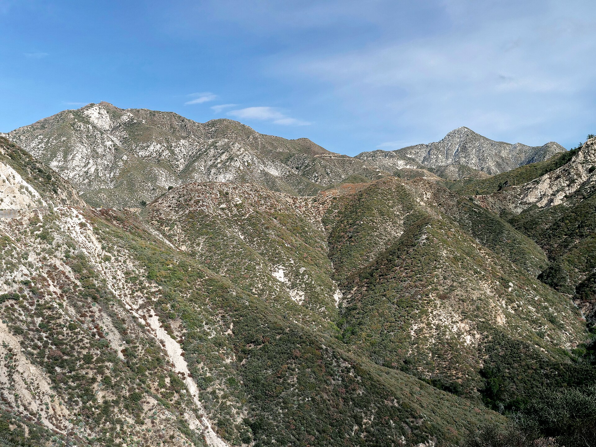
The short version
- Date: Saturday, October 2, 2027, 5:00 AM (37th annual).
- Start and finish: Loma Alta Park, 3330 Lincoln Ave, Altadena, California.
- Distance: about 100.8 miles. The official materials call it the Front Range Loop.
- Climbing: about 20,000 feet up and the same down, per the Race Book and UltraSignup.
- High and low: 1,147 feet in the Arroyo Seco to 6,194 feet on Mt. Hillyer (Race Book).
- Time limit: 33 hours (2:00 PM Sunday). Average pace to finish: 19:39 per mile.
- Entry: lottery. The 2027 lottery closed October 26, 2026 and the entry list is published. The 100 is listed as sold out on UltraSignup at $440 ($472.10 with fees), with a no-charge waitlist.
- To start you need: a finish at an official race of 50 miles or longer between January 1, 2026 and September 2, 2027, plus 8 hours of trail work by September 2, 2027.
- Pacers: from Chilao-1, mile 49.1. Swaps only at Chilao-2 and Chantry Flats.
- Crew: one vehicle, seven stops on course. Or enter the Solo division: no crew, no pacer.
- Drop bags: ten on-course bag stops (eight places, two of them visited twice) plus a finish bag. Poles: allowed the whole way.
- Also in 2027: the first Angeles Crest 100K (about 62.5 miles, 11,879 feet, 7:00 AM start, no crew or pacers; $275 on UltraSignup through March 31, 2027, then $325).
- Race director: Ken Hamada. Official site, registration and rules for entry, Race Book, UltraSignup.
What kind of race this is
Angeles Crest is one of the original five American hundreds and it still behaves like it. Check-ins are written down by hand and relayed by ham radio operators. Nobody weighs you. The course is marked with yellow ribbon and powder. Every runner owes the forest a day of trail work before they're allowed to start, and runners who live in California south of Fresno have to do it with the race, in the Angeles National Forest.
The buckles are old-school too: solid sterling silver for under 24 hours, a bronze Second Sunrise buckle for 24:00:00 to 24:59:59, and a bronze Ram for everyone else under 33. Per the 2026 Race Book you collect them in person at the awards ceremony after the 2:00 PM cutoff on Sunday, or send someone; they aren't mailed.
One number tells you how hard this range is. Jim O'Brien ran 17:35:48 on the original course in 1989, and the race's own history page still lists it as the men's record. In 2026, the first year of the loop, the winners ran 20:12:08 (Eduardo Morales) and 22:56:58 (Taelor Smith). 109 runners finished, 13 of them under 24 hours, and the last one came in at 32:55:40, less than five minutes inside the limit. The median finisher took 29:13.
Getting in
- Lottery. It runs through UltraSignup each October. If you're drawn, your card is charged automatically; there's no accept step, and entries don't transfer or defer unless the race is cancelled. Odds improve with previous finishes, previous misses, volunteering, entering Solo, and chasing four or more straight finishes.
- Waitlist. Unselected runners are listed in lottery order. When a spot opens, usually around the refund deadlines (50% through April 1, 2027, 25% through August 1, 2027), UltraSignup emails an invitation you can accept or decline before you're charged.
- Sterling Silver Tickets. The top two men and top two women at designated races get in without the lottery. They still pay the entry fee and do the trail work. The 2027 list is mostly Southern California races of 50 miles or more, with one in Arizona: the Old Pueblo 50 in Sonoita on March 6, 2027. The top two men and women in the 2027 AC 100K earn tickets to the 2028 hundred.
- Volunteer route. Each checkpoint leader can nominate one runner past the lottery. That runner still pays and still does the trail work.
Then finish the two jobs: the 50-mile qualifier (results must be published online; virtual races don't count) and the 8 hours of trail work, both by September 2, 2027. AC100 trail work days are posted starting in spring 2027. Runners who live north of Fresno, outside California or abroad can do comparable work with a local trail organization and submit it through the race's trail work form.
The race site doesn't say whether the loop counts as a Western States qualifier in 2027. If you need it for that, check the Western States qualifier list before you count on it.
The loop in six acts
The descriptions below follow the 2026 Race Book, which was written by San Gabriel locals for this exact loop. The 2027 chart uses the same checkpoints and mileages, but read the 2027 Race Book when it's posted. One trap: the Race Book button on the race's course page still opens the 2024 book for the old point-to-point course. The loop edition is on the Race Book page. The official course page has the map, the elevation profile and the GPX.
The 100K course has its own official CalTopo map here, and the race's YouTube channel has training-run videos covering the loop in four pieces.
Act 1: the Arroyo and two climbs (0 to 24.6). You start on headlamps, run neighborhood streets down to a short dirt trail that leads to JPL and the mouth of the Arroyo Seco, and you hit the low point of the course inside the first mile. From there it's the Gabrielino Trail north up the canyon. You'll pass the El Prieto junction you come back through at mile 97; don't take it now. At Brown Mountain Dam the trail climbs around the dam, and if you find yourself looking at the dam face you've missed the bypass, so go back to the junction. It's singletrack the rest of the way, with Switzer's picnic area just past mile 10 and a final climb to Clear Creek at 11.2. That's just under 3,000 feet of climbing with no aid until you get there.
From Clear Creek you cross the highway junction and climb a fire road about 1,900 feet to Josephine Peak at 5,500 feet. At Josephine Saddle you turn left for the last 2.5 miles to the top. It's an out-and-back spur, and you have to check in at the summit: skip it and you're disqualified at Red Box. Back at the saddle, chaparral singletrack traverses around and under Strawberry Peak to the Colby Canyon junction near mile 20, where a right turn starts a 770-foot climb in 1.9 miles to Lawlor Saddle. Then it's smooth singletrack down to Red Box, where you see your crew for the first time.
Act 2: the Rincon road and the river (24.6 to 42.7). Red Box to Newcomb is on the Red Box-Rincon fire road the whole way: 5.5 mostly exposed miles down to West Fork, then 955 feet up in 3.1 miles to Newcomb Saddle. From Newcomb you keep descending the fire road for about a mile, turn left onto Edison Road, and reach the West Fork of the San Gabriel River around mile 37. What follows is a 6.2-mile, 2,030-foot exposed climb to Shortcut Saddle on Highway 2. Stay on the fire road to the aid station; the singletrack connector just below it is not the course. That's 18.1 miles between crew stops through the warmest part of the day, with one remote aid station in the middle.
Act 3: the high country (42.7 to 62.9). The Silver Moccasin Trail drops 500 feet in 0.8 miles out of Shortcut, then climbs an exposed 1,245 feet in 1.8 miles to Charlton Flats before rolling on to Chilao through several road crossings and quick turns. Pacers can join at Chilao. Then comes a 7.4-mile out-and-back: north on the paved road, up the Silver Moccasin toward Horse Flats, left through a boulder field laced with climbers' side trails, and over Mt. Hillyer, the high point at about 6,200 feet. The aid station is a quick mile down the far side, and crews aren't allowed there. You come back the same way to Chilao, then back to Shortcut, where the 1.8-mile climb is now a technical descent and the leg ends with that 500-foot climb in 0.8 miles.
Act 4: the canyon again (62.9 to 78.7). From Shortcut-2 you cross Highway 2 and take dirt roads the whole way to Newcomb: a 6.5-mile gradual descent to the river, 2 miles up to the Red Box-Rincon road, then a right turn and less than a mile to the saddle. The median 2026 finisher did this between about 10 PM and 1 AM. From Newcomb a half-mile traverse leads to Newcomb Pass, where the course turns left onto the Gabrielino Trail and drops into Big Santa Anita Canyon: 5.2 miles of narrow singletrack down toward Sturtevant Camp and on through the canyon, steep and somewhat technical, in a canyon that burned in the Bobcat Fire and flooded afterward. Watch the markers through the washouts. After the bridge at the bottom you climb 350 feet in 0.6 miles of pavement to Chantry Flat at 2,140 feet.
Act 5: Chantry to Wilson (78.7 to 84.8). The Race Book calls it 6.1 miles and 4,000 feet. More on this below.
Act 6: sixteen miles home (84.8 to 100.8). From the Mt. Wilson parking lot you run the paved Mt. Wilson Road down to Eaton Saddle (the same road crews drive up), turn left onto dirt, go through the Mueller Tunnel, and follow the Mt. Lowe Motorway down to the Sam Merrill aid station at about 4,400 feet. Another 2.7 miles of dirt road leads to the Sunset Trail at the Cape of Good Hope, where you turn right onto singletrack for 2 miles, hit about 0.3 miles of pavement, and turn right again onto the trail down to Millard Campground at 1,880 feet. That second right is the one people miss: if you're on pavement for more than a few minutes, go back. From Millard the course climbs 300 feet in 0.7 miles on the dirt canyon road, turns hard right at Brown Mountain Road, and drops into the Arroyo on the El Prieto singletrack with a string of creek crossings. You come out on the road you started on, run past JPL, climb a short connector to West Altadena Drive, and finish by way of Lincoln Avenue and Palm Street.
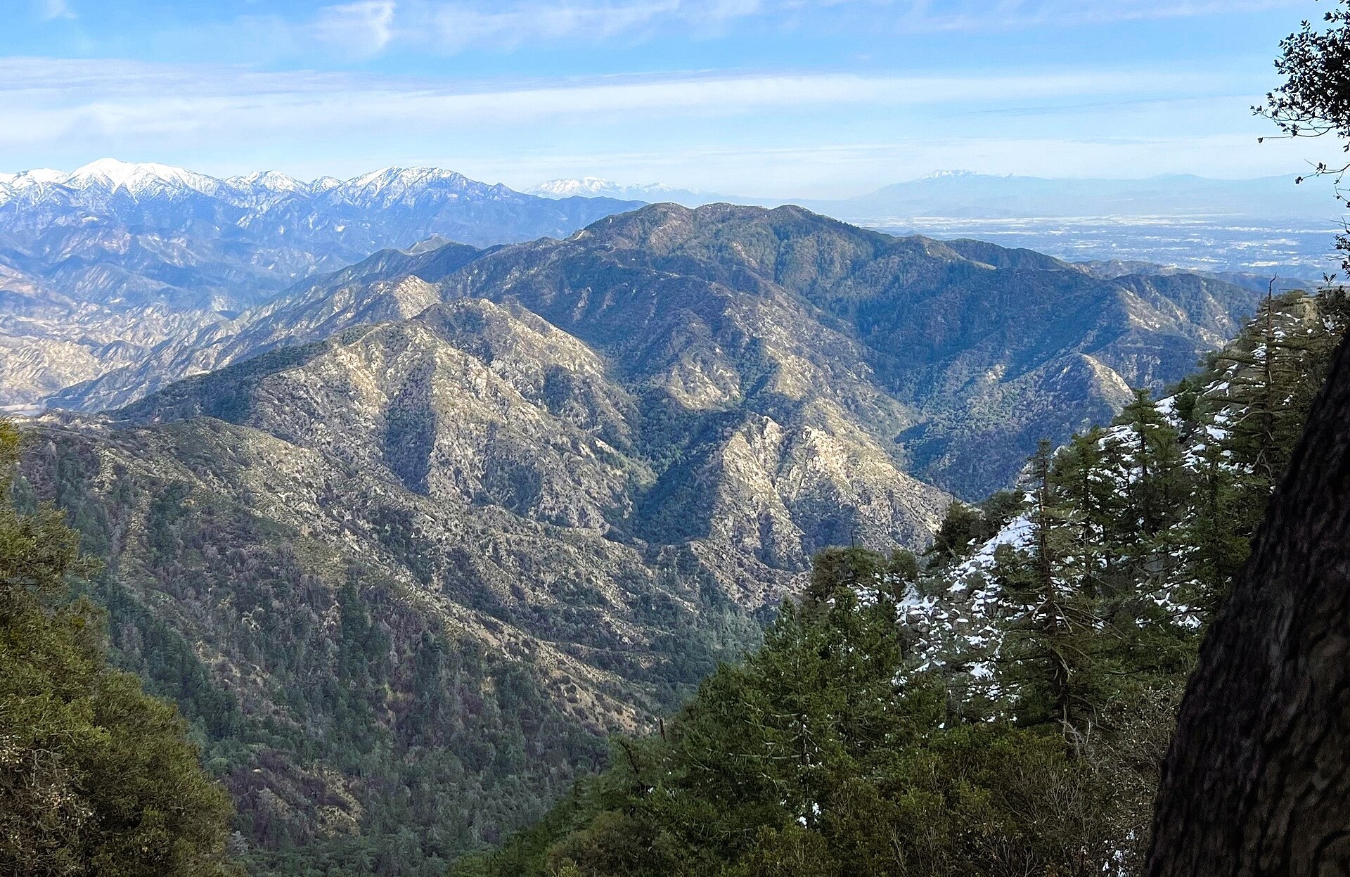
Aid stations and cutoffs
From the official 2027 Checkpoint Cutoff Chart. Cutoffs are leave-by times, enforced by the aid station captain. Elevations are from the Race Book where it gives one and rounded from the GPX otherwise.
| Aid station | Mile | To next | Elev. (ft) | Crew | Drop bag | Pacer | Leave by | Notes |
|---|---|---|---|---|---|---|---|---|
| Loma Alta Park (start) | 0 | 11.2 | 1,300 | Yes | No | No | 5:00 AM Sat | Longest stretch without aid comes first |
| Clear Creek | 11.2 | 4.1 | 3,650 | No | Yes | No | 8:30 AM | On the highway, but crews may not stop |
| Josephine Peak | 15.3 | 9.3 | 5,500 | No | No | No | none | Out-and-back spur; check in at the top. Fill everything for 9.3 miles |
| Red Box | 24.6 | 8.6 | 4,600 | Yes | Yes | No | 12:25 PM | First crew stop |
| Newcomb-1 | 33.2 | 9.5 | 4,000 | No | No | No | none | Remote. River, then the exposed climb to Shortcut |
| Shortcut-1 | 42.7 | 6.4 | 4,780 | Yes | Yes | No | 5:45 PM | Separate bag from Shortcut-2. Back of the pack: take a light |
| Chilao-1 | 49.1 | 3.7 | 5,250 | Yes | Yes | Yes | 8:10 PM | First pacer pickup. Most runners need a light from here |
| Mt Hillyer | 52.8 | 3.7 | 5,900 | No | No | No | 9:40 PM | Course high point a mile before it. No crew, no hike-ins |
| Chilao-2 | 56.5 | 6.4 | 5,250 | Yes | Yes | Swap | 11:00 PM | Night layers and the long stop |
| Shortcut-2 | 62.9 | 9.5 | 4,780 | Yes | Yes | No | 1:25 AM Sun | Last crew for 15.8 miles |
| Newcomb-2 | 72.4 | 6.3 | 4,000 | No | No | No | none | Remote. Do not plan to stop here |
| Chantry Flats | 78.7 | 6.1 | 2,140 | Yes | Yes | Swap | 6:20 AM | Last pacer swap. The big climb is next |
| Mt Wilson | 84.8 | 5.6 | 5,600 | Yes | Yes | No | 9:35 AM | Last crew stop |
| Sam Merrill | 90.5 | 6.0 | 4,400 | No | Yes | No | 11:05 AM | Behind locked gates |
| Millard | 96.5 | 4.4 | 1,880 | No | Yes | No | 12:50 PM | Behind locked gates. No crew, no hike-ins |
| Loma Alta Park (finish) | 100.8 | 1,300 | Yes | Yes | 2:00 PM Sun | Finish-line bag goes down race morning |
Things in that chart worth a second look:
- Josephine Peak and Newcomb have no cutoff on purpose. The race doesn't want anyone stopping there. In its words: "Transporting dropped runners out of these locations is extremely difficult." The 2026 Race Book treats both as no-drop stations: short of a real medical problem, you keep moving to the next checkpoint even if you expect to miss the cutoff there. Under the rules, a runner who drops at Newcomb, Sam Merrill or Millard generally waits until the station closes for a ride.
- The first cutoff is the one that catches people. Clear Creek by 8:30 AM is 11.2 miles and nearly 3,000 feet in 3 hours 30 minutes. In the official 2026 finish splits, 59 of the 109 finishers were recorded there at 7:30 or later, and the last of them at 8:24.
- Red Box by 12:25 PM is 24.6 miles and, by the Race Book's section figures, more than 5,500 feet of climbing in 7 hours 25 minutes. The latest Red Box time among 2026 finishers was 12:11 PM.
- The chart gives Chantry to Mt. Wilson 3 hours 15 minutes for 6.1 miles. That's a 32-minute mile, built into the official cutoffs.
- The last 16 miles are not free. At cutoff pace you get 1:30 for the 5.6 miles to Sam Merrill, 1:45 for the 6.0 down to Millard and 1:10 for the last 4.4, about 16 to 17.5 minutes per mile on tired legs.
Carry rule: you must carry your own fluids, food and clothing between checkpoints, and your pacer can't carry them for you. With gaps of 11.2, 9.3 and 9.5 miles (the last one twice), plan for two to three hours of water at a time.
What's on the tables. The 2026 Race Book lists water, Tailwind, ice, sweet and salty snacks, soda, fruit and hot soup at night, and says not to expect gels. If your stomach depends on a specific product, it goes in a drop bag.
Crew guide: one car, two highways
Each runner gets one crew vehicle on the course. It needs two things on the dash: the AC100 Vehicle ID Pass from check-in, and an Adventure Pass ($5 a day or $30 a year) or an America the Beautiful pass for parking in the national forest. The race pass doesn't replace the forest pass. You don't need an Adventure Pass to park near the finish.
Crews can go to Red Box, Shortcut (twice), Chilao (twice), Chantry Flats and Mt. Wilson, plus the start and finish. That's it. No meeting your runner at Clear Creek, at highway crossings, at trailheads or pullouts, and no hiking in to Mt. Hillyer, Sam Merrill or Millard. First violation holds the runner for an hour. The second disqualifies them.
Drive distances, drive times and coordinates in this table are the 2026 Race Book's. The last column is the median checkpoint time of the 109 finishers in the official 2026 splits, which is a better guide than the leaders' projection for when most crews are needed.
| Crew stop | Mile | Drive from previous stop | Leaders / cutoff | Median 2026 finisher | GPS |
|---|---|---|---|---|---|
| Red Box | 24.6 | 18.5 mi, 31 min (from start) | 9:10 AM / 12:25 PM | 10:45 AM | 34.25816, -118.10521 |
| Shortcut-1 | 42.7 | 5 mi, 8 min | 11:45 AM / 5:45 PM | 3:06 PM | 34.27349, -118.03274 |
| Chilao-1 | 49.1 | 7.7 mi, 12 min | 1:00 PM / 8:10 PM | 5:30 PM | 34.32731, -118.00813 |
| Chilao-2 | 56.5 | stay put | 2:20 PM / 11:00 PM | 7:48 PM | same |
| Shortcut-2 | 62.9 | 7.7 mi, 12 min | 3:30 PM / 1:25 AM Sun | 9:54 PM | 34.27349, -118.03274 |
| Chantry Flats | 78.7 | 36.2 mi, 56 min | 5:50 PM / 6:20 AM | 2:50 AM | 34.19637, -118.02308 |
| Mt. Wilson | 84.8 | 35 mi, 1 hour | 7:40 PM / 9:35 AM | 6:08 AM | 34.22343, -118.06255 |
| Finish | 100.8 | 23.5 mi, 43 min | 10:00 PM / 2:00 PM | 10:13 AM | 34.20074, -118.15640 |
Every crew stop is reached on paved roads, and nothing in the Race Book's directions calls for high clearance or four-wheel drive. The whole circuit is about 134 miles of driving.
- Loma Alta Park (start/finish). Per the 2026 Race Book: don't use the park's own lots, and don't park on Palm, Dabney or directly in front of homes. Use the street parking along Loma Alta Drive and Lincoln, and read the signs. The neighborhood was hit by the Eaton Fire in January 2025 and the race's permit depends on the neighbors.
- Red Box (24.6). Lincoln Avenue south, Woodbury and Windsor to I-210 west, then Exit 20 and 13.8 miles up the Angeles Crest Highway (SR 2) to the Red Box picnic area on the right. You'll drive past the Clear Creek aid station on the way; don't stop. Pit toilets and water spigots at Red Box. If the lots are full, park completely off the road inside the white line.
- Shortcut Saddle (42.7 and 62.9). Five more miles up SR 2, in a large turnout on the left, right beside the highway. Parking is very tight, there are no toilets, runners cross the road here, and weekend traffic is fast. Keep children close.
- Chilao (49.1 and 56.5). Another 7.3 miles on SR 2. Skip the first left, which goes to the overnight campground, and take the next one at the Forest Service sign for Chilao Day Use and the visitor center. Pit toilets and water spigots. This is the best place for a real stop: your runner comes through twice, 7.4 miles apart, so the crew stays put for the Hillyer out-and-back. It gets crowded for the same reason; the Race Book suggests dropping one person with the gear and parking out on the highway if the lot is full.
- Chantry Flats (78.7). This is the awkward one. Chantry is reached only from the valley: all the way back down SR 2 to La Cañada, I-210 east about 11 miles to Exit 32 (Santa Anita Avenue), then left and 5 miles uphill to the end of the road. The Race Book notes most crews have 20 to 40 minutes to buy food and gas in La Cañada on the way, and that the lot at the top fills, so park in the turnouts as you approach instead of driving into the aid station and getting stuck. The Chantry road has posted public gate hours on ordinary days and the Race Book doesn't address them, so check the race's current crew instructions for overnight access.
- Mt. Wilson (84.8). Back down to the 210, west to Exit 20, 13.8 miles up SR 2 to Red Box, then right on Mt. Wilson Red Box Road, narrow and winding, to the top. Keep right at the Y onto the one-way circle road; in 2026 the observatory parking lot gate on the right was open for the race and the lot is large. Runners leaving Mt. Wilson are on this same road down to Eaton Saddle, so drive it slowly. The median 2026 finisher took 3:09 from Chantry to the summit, which leaves time for a one-hour drive, but crews of fast runners need to move.
- Or skip Mt. Wilson. The Race Book says outright that some crews go straight from Chantry to the finish and sleep. If you do, make sure the Mt. Wilson drop bag has everything.
Things crews should know:
- Fill the tank and download offline maps before you go up. There is no gas on Highway 2 and, per the Race Book, essentially no cell service along it. You can't look up the next stop from Red Box.
- Check Highway 2 before you leave. As of the 2026 Race Book, SR 2 was closed indefinitely east of the course, and other sections close for rockfall. Look at Caltrans road conditions the week of the race and again that morning.
- No pacing your runner by car. The rules forbid driving alongside runners or slowing below 25 mph on the highway.
- Pacers can't leave cars at aid stations. They ride in the crew vehicle or get dropped off. A pacer's parked car can get the runner disqualified.
- Agree on a plan and a schedule before the start. The race posts live data relayed by the ham radio team, but you'll only see it where you have signal.
- No dogs at aid stations or on the course.
- The gaps are long. Start to Red Box is 24.6 miles without crew. Red Box to Shortcut-1 is 18.1. Shortcut-2 to Chantry is 15.8. Pack drop bags for Clear Creek and for anything your runner can't go four hours without.
Check-in and bags. Packet pickup is Friday, in person with photo ID; nobody can pick up for you. Drop bags are accepted Friday, October 1, 2027, from 8:00 to 10:30 AM at Loma Alta Park and leave at 11:00 sharp. Label each with name, bib number and checkpoint, and pack separate bags for Shortcut-1, Shortcut-2, Chilao-1 and Chilao-2. In 2026 check-in ran 8:00 AM to noon, the pre-race briefing was 2:00 to 4:00 PM, and every runner had to check in again from 4:00 AM on race morning; confirm the 2027 times in the new Race Book. The race lists lodging on its site. The Race Book says most runners fly into LAX and that Burbank is the closest airport. From Phoenix, Altadena is roughly 370 miles by road, most of it I-10.
Pacers
One pacer at a time, starting at Chilao-1 (49.1). They can swap only at Chilao-2 (56.5) and Chantry Flats (78.7). There's no swap at Shortcut or Mt. Wilson, even though crews are there.
That makes for three natural legs: the 7.4-mile Hillyer out-and-back, 22.2 miles from Chilao-2 to Chantry through the canyon at night, and 22.1 miles from Chantry to the finish with the Wilson climb. Give the Chantry leg to your strongest climber and your most stubborn friend.
Exceptions: runners 65 and older, and men 60+ or women 55+ with at least seven finishes, can have a pacer from the start. Runners without a pacer can ask the Chilao or Chantry captains on the day or try the race's Facebook page in advance; out-of-state runners get priority.
Where poles earn their place
Poles are allowed for the whole race and can be picked up or dropped at aid stations. Climb figures here are the 2026 Race Book's.
- Clear Creek to Josephine Peak: about 1,900 feet in 4.1 miles on fire road. Steady, sustained, good pole terrain.
- The river to Shortcut-1: 2,030 feet in 6.2 exposed miles, in the afternoon.
- Shortcut-1 to Charlton Flats: 1,245 feet in 1.8 miles, also exposed, right after you leave your crew.
- The river to Newcomb-2: roughly 1,100 feet on dirt road, at night.
- Chantry Flats to Mt. Wilson: 4,000 feet in 6.1 miles. If you only carry poles for one section of this race, it's this one.
- Sam Merrill to Millard: about 2,500 feet down on quads that have already done 90 miles. A pole is a brake.
The pole plan: many runners will simply carry folding poles from the start, because there's a real climb in every act. If you'd rather run free early, the cleanest pickups are your Clear Creek drop bag (11.2) before Josephine, or your crew at Red Box (24.6). Whatever you do, have them in hand leaving Chantry: put a spare pair in the Chantry drop bag in case your crew is late getting around the mountain.
What the Race Book and the 2026 splits tell you
A note on sources. The loop has been raced once, and I haven't found independent runner reports on it to cite, so nothing here is credited to Reddit or to anyone's blog. It comes from two places: the 2026 Race Book, whose course notes were written by local runners who know these trails, and my own reading of the official 2026 finish splits, which cover the 109 finishers only.
- Shortcut is where the locals expect trouble. The Race Book's authors single out Shortcut as an aid station that sees more than its share of runners in bad shape, because of the hot, exposed climb that leads to it. Their advice is to reset there, since another exposed climb starts within a mile.
- Get in the river. The same notes say that unless race weekend is unusually cool, it will be getting warm for most runners by the West Fork crossing near mile 37, and that the smart move is to get wet before the 6.2-mile climb. The median 2026 finisher left Newcomb-1 around 12:35 PM and reached Shortcut at 3:06, so the climb falls in the hottest part of the afternoon.
- It's warm low and cold high. The Race Book gives Altadena's early October averages as highs of 79 to 81 and lows of 58 to 60, and warns that the upper course can be windy and cold at night. Chilao, Mt. Hillyer and Mt. Wilson all sit between about 5,250 and 6,200 feet.
- It's a long night. In early October Los Angeles gets a little under 12 hours of daylight, with sunrise around 6:50 AM and sunset around 6:35 PM. You start with about an hour and a half of dark. The median 2026 finisher was at Mt. Hillyer at sunset and at Mt. Wilson just before sunrise, which is 11-plus hours on a headlamp.
- Chantry to Wilson took the median finisher 3:09. The winner did it in 1:53. Thirty-seven of the 109 finishers took longer than the 3:15 the chart allows and finished anyway, because they arrived at Chantry with time to spare. The slowest finisher's split was 4:40.
- The last 16 miles took the median finisher 4:20. The chart allows 4:25 from the Mt. Wilson cutoff. The 15 finishers who came through Mt. Wilson in the final hour before the cutoff needed between 4:11 and 5:00 to get home.
- Poison oak and poodle-dog bush. The Race Book flags poison oak on the Upper Winter Creek Trail out of Chantry and on the Sunset Trail into Millard, which are both places you'll want to sit down. Poodle-dog bush, the burn-scar plant that causes a similar rash, grows along the course, and the book's photos of it were taken in the last 10 miles. Long socks help, and so do alcohol wipes in the Mt. Wilson and finish bags.
- Announce yourself. Timing is by hand. The rules put it on you to make sure a volunteer records your number coming in and going out of every station. A missed check-in can be treated as a course cut.
- An IV ends your race. Per the race FAQ, taking one is an automatic drop.
- Solo is a real commitment, and a popular one. Solo runners can't take so much as a cup of ice from another runner's crew, and you can't switch divisions after registering. It does improve your lottery odds, and 34 of the 109 finishers in 2026 ran Solo. The Race Book's advice to them: keep your ID, cards, keys and phone on you, and don't plan on calling a ride from the forest.
- Fire and weather have a say. Since 2020 the race has been cancelled three times (2020, 2021, 2023) and run on an alternate course three times (2022, 2025, 2026). Only 2024 went point to point. Book refundable lodging and watch the race's news page.
The finish line is decided here
Chantry Flats, mile 78.7. Everything about it invites quitting. It's the first place in almost 16 miles where your crew and a warm car are waiting. You got there on a steep 5-mile descent with 20-plus hours in your legs, the median 2026 finisher arrived at 2:50 AM, and everyone knows what's next.
What's next, per the Race Book: 0.3 miles of gated paved road out of the upper parking lot, then the Upper Winter Creek Trail, which climbs gently for 1.6 miles and gives half a mile back. At the Winter Creek junction you turn left and the real climb starts: 2.7 miles and 2,200 feet, about a 16 percent grade, to the Mt. Wilson Toll Road. Dead Man's Bench sits 2.1 miles up that stretch, at the Mt. Wilson Trail junction, and it is exactly what it sounds like. From the bench the course no longer scrambles up the firebreak on Manzanita Ridge; it takes the Hal Winton Bypass, a singletrack that race volunteers built beside the ridge in 1999. You top out just under 5,000 feet, turn right on the dirt toll road for half a mile, and take the Mt. Wilson Trail on the right to the antennas at about 5,600 feet. The old course stopped at the toll road. The loop does not.
The second trap is quieter: Newcomb Saddle, both times. You can't see a crew there and it's a no-drop station. A runner who decides at Newcomb-2 that they're finished still has 6.3 miles to walk to Chantry, and that walk has ended plenty of finishes that were still possible on paper.
The turning point is the top of Mt. Wilson. Leave Mt. Wilson with time in hand and you've done the last big climb. What's left is 16 miles with a net drop of about 4,300 feet. The caution is in the splits above: leaving right at the 9:35 AM cutoff gives you 4:25, and most of the back of the 2026 field needed more than that. Time in hand means at least 30 to 45 minutes. Every aid station after Mt. Wilson is behind a locked gate, so the only quick way out from there is the finish line.
How not to DNF at Angeles Crest
- Respect the early cutoffs. Don't hike the Arroyo as a warm-up. Aim to be through Clear Creek by 8:00 and to leave Red Box at least 45 minutes ahead of 12:25 PM.
- Treat the first canyon crossing as a heat problem. Ice in the hat and sleeves at Red Box, full bottles at Newcomb-1, soak yourself at the river, salt and steady calories on the climb to Shortcut.
- Use Chilao properly. You pass through twice in 7.4 miles. Take a light and a layer at Chilao-1, because unless you're near the front you'll come back from Hillyer in the dark. Do the long stop at Chilao-2: night layers, real food, fresh socks.
- Fix your stomach before Shortcut-2. After that it's 15.8 miles to your crew with one remote station. If you've stopped eating, deal with it at the car, not in the canyon.
- Never decide at Newcomb. The only question at Newcomb is what you need to get to Chantry.
- Have a Chantry script. Crew writes it before the race: sit for a set number of minutes, eat, change socks and shirt, poles in hand, pacer leads you out. No discussion of how you feel until you're walking. I wrote about what that part of a hundred does to your head in the altered state of mile 80.
- Climb Wilson by the clock, not the mile. Thirty-minute miles are on pace here. Keep moving, keep eating, and don't sit on the bench.
- At Mt. Wilson, don't get in the car. It's the last crew stop and it's cold. Refill, layer, leave.
Gear for this course
- Folding trekking poles for Josephine, the canyon climbs and Wilson, plus a quiver or belt so they're out of your hands on the fire-road miles.
- A hydration vest that carries 2 liters or more and a couple of extra soft flasks. Three sections are over 9 miles and you must carry your own.
- A bright rechargeable headlamp and a second light or waist lamp. You start in the dark and most of the field runs 11-plus hours of night, including the technical drop into Chantry.
- An ice bandana and sun sleeves for the exposed fire roads on either side of the river.
- Electrolyte capsules or drink mix you've already tested in heat. The aid stations pour Tailwind, so either train on it or carry your own.
- A packable wind jacket and light gloves for Hillyer and Mt. Wilson at night.
- Anti-chafe balm and spare merino socks in the Chilao-2 and Chantry bags. Crew-length socks also keep poodle-dog bush off your ankles.
- Trail gaiters for the dusty fire roads and decomposed granite.
- For the crew: a folding camp chair and a hard cooler full of ice, bought before you leave the city. Buy the Adventure Pass before race day too.
How it compares
For readers coming from Arizona races: Angeles Crest lists about 4,000 feet more climbing than Mogollon Monster (roughly 20,000 against 15,900) and gives you five fewer hours to do it (33 against 38). Crew access is nothing like Javelina, where you pass your tent every loop. The other well-known Southern California hundred is San Diego 100, which I ran in 2026 and wrote up separately. And if you're wondering whether a loop makes a hundred easier than a line, we took that question on in loop or line. Here the organizers expected the loop to run faster than the old course: more fire road, cooler October weather, and a high point 3,000 feet lower. The first winner still needed 20:12.
The van idea
Look at what an Angeles Crest crew actually does: up a mountain highway by mid-morning, three stops strung along SR 2, a long evening at Chilao, down to the valley in the middle of the night, up a different canyon to Chantry, back around to the top of Mt. Wilson before dawn, and down to Altadena. It's 24-plus hours and about 134 miles in one vehicle, with no gas and nowhere to buy ice on the mountain.
That's the job we're designing AZ Ultra Vans for: a crew van as a rolling base camp, with a fridge and ice, shade for the Chilao afternoon, a bed for the crew member who isn't driving, and compression boots for the runner at Loma Alta Park. Right now it's a reservation-interest waitlist so we can see which races people want it for. We're not promising availability for any race yet. If Angeles Crest is on your list, add your name on the card above or at van.azsvinternal.com.
Angeles Crest 100 FAQ
When is the 2027 Angeles Crest 100? Saturday, October 2, 2027, starting at 5:00 AM at Loma Alta Park in Altadena. The final cutoff is 2:00 PM Sunday.
Does Angeles Crest still start in Wrightwood? Not currently. Since 2026 the race has been a loop that starts and finishes at Loma Alta Park in Altadena, because of fire damage and Highway 2 closures. The organizers say they intend to return to the traditional route when access and safety allow.
How much climbing is there, and can I use poles? About 20,000 feet over 100.8 miles, from 1,147 feet in the Arroyo Seco to 6,194 feet on Mt. Hillyer. Poles are allowed for the entire race.
What is the time limit? 33 hours. Intermediate cutoffs include Clear Creek (mile 11.2) at 8:30 AM Saturday, Red Box (24.6) at 12:25 PM, Chilao-1 (49.1) at 8:10 PM, Chantry Flats (78.7) at 6:20 AM Sunday and Mt. Wilson (84.8) at 9:35 AM.
Where can my crew meet me? Red Box, Shortcut Saddle (twice), Chilao (twice), Chantry Flats and Mt. Wilson, plus the start and finish. Crews are not allowed at Clear Creek, Josephine Peak, Newcomb, Mt. Hillyer, Sam Merrill or Millard.
Where can pacers join? At Chilao-1, mile 49.1. Pacers can swap only at Chilao-2 (56.5) and Chantry Flats (78.7). Solo division runners can't have pacers.
What do I need to qualify? A finish at an official race of 50 miles or longer between January 1, 2026 and September 2, 2027, and 8 hours of trail work by September 2, 2027. Then you need to be drawn in the lottery or come off the waitlist.
Is there a shorter race? Yes. The first Angeles Crest 100K runs the same day at 7:00 AM: about 62.5 miles and 11,879 feet, with no crew or pacers and 4 hours of trail work required. Its cutoffs and drop-bag locations hadn't been published when we wrote this.
Who wrote this
Johnathon Lawson is a Gilbert, Arizona ultrarunner, track and cross-country coach and father of three, and a three-time 100-mile finisher: Zion 100 (2025), Mogollon Monster 100 (2025) and San Diego 100 (2026). He hasn't raced Angeles Crest; this guide is researched from the official race materials, the official GPX and published results. Follow his training on Strava, his results on UltraSignup, and AZ Ultra Adventure on YouTube and Instagram.
Sources: AC100 official site, registration page, 2027 Checkpoint Cutoff Chart, race rules, FAQ, 2026 Race Book, course overview and GPX, course history, 2026 results and 2026 finish splits; UltraSignup. Course descriptions, climb figures, drive times and coordinates are from the 2026 Race Book and may be revised for 2027. Split statistics are our own arithmetic on the official 2026 finish splits. Dates, cutoffs and crew access can change, and fire or road closures have changed this course before: check the race's current runner materials before race week.
Some links are Amazon affiliate links. As an Amazon Associate we earn from qualifying purchases, at no extra cost to you.